Montana Snow Predictions 2026-2027: A Rare Hurricane-Fed Storm Hits This Week

A rare storm fed by Hurricane Rachel's remnants is forecast to drop 6-12 inches on Montana Oct 10-12, 2026. Real climate normals, first-snow records, and what it means for the season.
Advertisement
The National Weather Service office in Missoula called it "a very rare circumstance." Remnant moisture from Pacific storm Rachel is combining with a cold front to drop snow across Montana from 10 through 14 October 2026. Totals vary sharply by elevation, from a few inches along Interstate 90 to close to a foot at ski-area elevations in the southwest. It is one of the earliest widespread snow events the region has seen, landing before most people have thought about winter tires.
Key facts (forecasts issued 9-10 October 2026):
Storm window: 10-14 October 2026, heaviest 10-12 October
Forecast snow, valleys: 6-12 inches as low as 4,000 feet, locally up to 1 foot at the highest elevations
Forecast snow, ski areas: Big Sky 11 inches, Bridger Bowl 10 inches, per Chris Tomer's resort outlook
I-90 travel impact: up to 3 inches of wet snow and gusts to 35 mph on affected stretches, per the NWS winter weather advisory
Why it's rare: moisture from a weakening Pacific tropical system combining with a cold front, an unusual setup this early in the season
Areas named: Montana, Wyoming and Idaho, with Glacier and Yellowstone national parks specifically flagged
Montana's seasonal snow normals: Great Falls 63 inches, Billings 57 inches, Missoula 43 inches (1991-2020)
Montana's earliest snowfall record: Billings, 7 September 1962, 2 inches
This winter's outlook: NOAA favors below-normal precipitation and above-normal temperatures for Montana, but the Farmers' Almanac and OpenSnow's own analogs don't fully agree
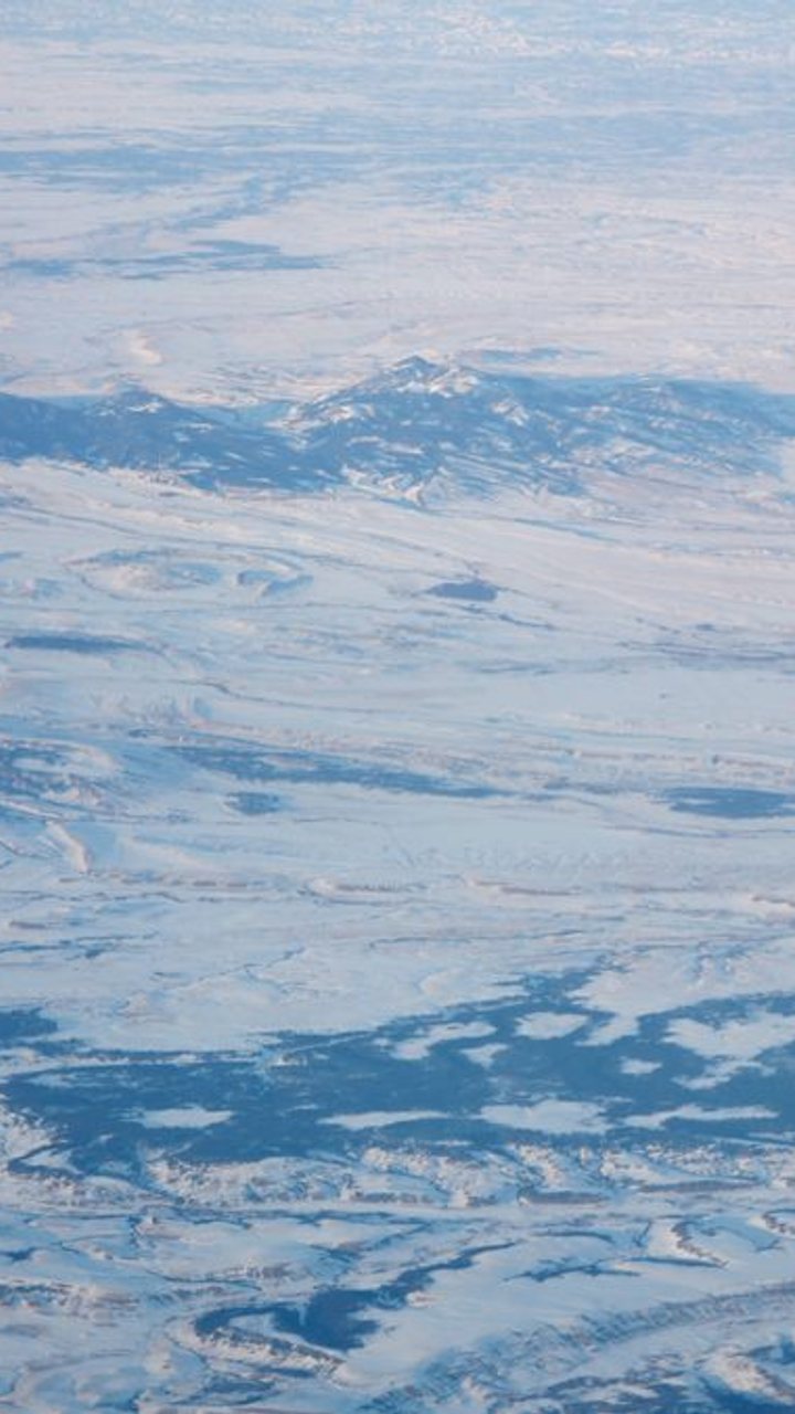
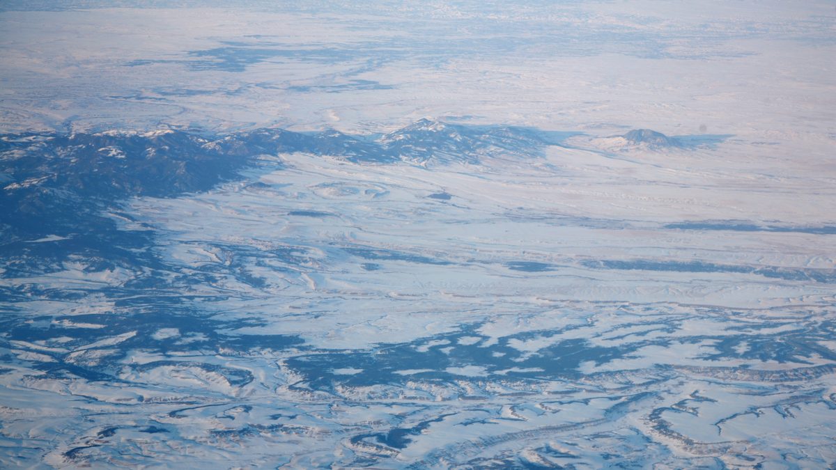
Winter over the Judith Mountains, Fergus County, Montana. Photo: Daniel Schwen, CC BY-SA 4.0.
What is happening with snow in Montana right now?
A rare early-season storm is dropping widespread snow across Montana, Wyoming and Idaho from 10 through 14 October 2026, heaviest 10-12 October. AccuWeather forecast 6 to 12 inches at elevations as low as 4,000 feet in the northern Rockies, with up to a foot possible at the highest elevations, and snow reaching some valley locations for the first time this season. Ski-specific outlooks put Big Sky at 11 inches and Bridger Bowl at 10, among the higher resort totals in the state.
Lower elevations are seeing far less. A National Weather Service winter weather advisory for western Montana, including stretches of Interstate 90, called for up to 3 inches of wet snow and wind gusts to 35 mph, running roughly from the evening of 10 October through the evening of 11 October 2026. If you're driving I-90 through that window, expect slick spots and reduced visibility rather than a major accumulation.
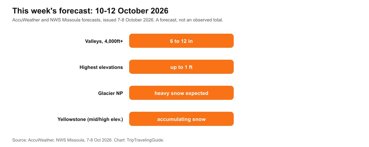
The 10-14 October 2026 forecast at a glance. A forecast, not an observed total, as conditions can shift.
Why is this snow event considered rare?
Because the moisture feeding it came from a tropical system, not a typical early-autumn cold front alone. The National Weather Service's Missoula forecast discussion described the moisture reaching the Yellowstone and Wyoming area as "a very rare circumstance." A large low-pressure trough over the West interacted with that moisture, and cold air behind an advancing front dropped snow levels low enough to bring accumulating snow to valley floors rather than just mountain peaks.
Advertisement
The storm's name and strength is reported inconsistently across outlets. The system, Rachel, briefly reached hurricane strength in the eastern Pacific before weakening, and some reports still call it a hurricane while others correctly call it a tropical storm by the time its remnants reached the Rockies. Either way, the moisture plume is the same, and it is what is driving the 10-14 October snow.
Which parts of Montana are most affected?
Glacier National Park and the areas near Yellowstone are specifically named for heavy, accumulating snow. AccuWeather meteorologists said snow levels would drop much lower than usual across parts of Idaho, Montana and Wyoming, bringing snow to some valleys for the first time this season, with the heaviest totals expected at higher elevations in the northern Rockies.
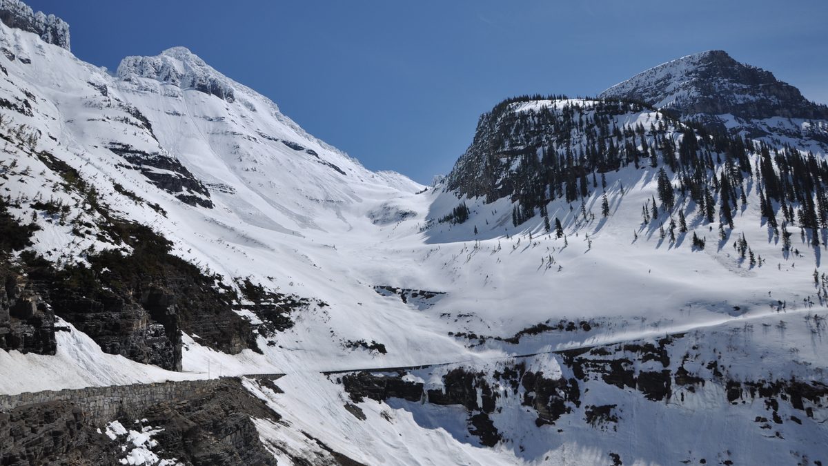
Snow in Glacier National Park. Photo: Glacier National Park Service, public domain.
How much snow does Montana get in a normal year?
Great Falls averages 63 inches a season, Billings averages 57, and Missoula averages 43, per 1991-2020 climate normals. The higher mountain areas, including the Lake Superior-style snowbelts around Glacier National Park, run far above any of these city totals.
City | 1991-2020 seasonal normal |
|---|---|
Great Falls | 63 in |
Billings | 57 in |
Missoula | 43 in |
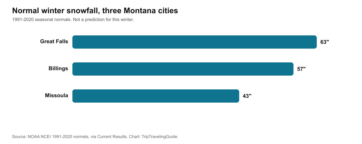
Three Montana cities, three different normals, all well short of what the high Rockies see in a typical winter.
Has Montana seen snow this early before?
Yes. Billings holds the state's earliest measurable-snowfall record, 2 inches on 7 September 1962, more than a month earlier than the 10-14 October 2026 storm. Great Falls has its own early-snow history too. 8.3 inches fell there on 22-23 August 1992, the only measurable August snow on record there since 1886. Early snow is rare in any single year, but Montana's own record shows a storm this early is not unprecedented.
Does this storm mean Montana is in for a snowy winter?
Not necessarily. NOAA's Climate Prediction Center favors below-normal precipitation and above-normal temperatures for Montana this winter, one of the quietest storm tracks in the country under this year's strong El Nino. The Farmers' Almanac disagrees with itself on the state: its regional zone outlook describes sudden snow squalls and bitter cold, while its own separate Montana City long-range page calls for above-normal snowfall.
OpenSnow splits the state in two. Northern Montana is favored for below-normal snowfall. Southern Montana, including Big Sky, Bridger Bowl and Red Lodge, has no clear signal either way, though OpenSnow's historical analogs point to better odds of above-average snow in March specifically. One rare October storm is a single event, not the whole season, and even the season-long outlooks don't agree with each other.
Advertisement
Source | Montana call |
|---|---|
NOAA Climate Prediction Center | Below-normal precipitation, above-normal temperatures statewide |
Farmers' Almanac (zone outlook) | Sudden snow squalls, bursts of bitter cold |
Farmers' Almanac (Montana City long-range page) | Above-normal snowfall |
OpenSnow | North: below normal. South: no clear signal, possible above-average March |
Our USA winter forecast hub covers what NOAA and both almanacs expect for the full country this season.
What are the limits of this guide?
This storm's snow totals are a forecast issued 9-10 October 2026, not an observed final total, and mountain snowstorms routinely over- or under-deliver on a forecast by several inches in either direction. Treat the 6-to-12-inch and up-to-a-foot figures as what forecasters expected going into the storm, and check the National Weather Service's Missoula or Billings forecast offices directly for confirmed totals once the storm has passed.
Quick answers about Montana snow, October 2026
How much snow is Montana getting from this storm?
AccuWeather forecast 6 to 12 inches at elevations as low as 4,000 feet from 10-14 October 2026, with up to a foot at the highest elevations. Ski-specific outlooks put Big Sky at 11 inches and Bridger Bowl at 10.
Will I-90 in Montana be affected by snow?
A winter weather advisory called for up to 3 inches of wet snow and gusts to 35 mph on affected western Montana stretches, running roughly 10-11 October 2026. Expect slick spots, not a major accumulation, at highway elevations.
Why is this storm unusual?
Its moisture comes from the remnants of Pacific storm Rachel, which weakened from hurricane to tropical strength, and the NWS Missoula office called the setup a very rare circumstance for early October.
How much snow does Montana get in a normal winter?
Great Falls averages 63 inches, Billings 57, and Missoula 43, per 1991-2020 climate normals.
What is Montana's earliest snowfall on record?
Billings, 7 September 1962, with 2 inches, the earliest measurable snow recorded in the state.
Does this storm mean Montana will have a snowy winter overall?
Not necessarily, and forecasters don't fully agree regardless. NOAA favors below-normal snow for Montana this El Nino winter, while the Farmers' Almanac's own pages disagree with each other, and OpenSnow sees no clear signal for southern Montana.
Sources
National Weather Service, Missoula forecast office and winter weather advisory, 9-10 October 2026
AccuWeather, Brett Anderson and Adam Douty, northern Rockies snow forecast, 7-10 October 2026
Chris Tomer, resort-level snow outlook for Big Sky and Bridger Bowl, October 2026
Current Results, Montana city snowfall normals (NOAA NCEI 1991-2020)
Reporting on Billings' and Great Falls' earliest measurable snowfall records
OpenSnow, 2026-2027 winter forecast preview
Farmers' Almanac, Upper Midwest/Rockies zone outlook and Montana City long-range page, 2026-2027
Topics
Advertisement