Pittsburgh Winter Forecast 2026-2027: What 73 Winters Show

NOAA expects a record El Nino. Across Pittsburgh's 9 strong El Nino winters, 8 finished below normal, averaging 31.2 inches against a 44.1 inch normal.
Advertisement
Nobody issues a snowfall total for Pittsburgh five months ahead. Not NOAA, not the Farmers' Almanac, not the meteorologist on KDKA. Anyone printing a number like "Pittsburgh will get 38 inches this winter" invented it, because no forecast system in the world has that skill at that range.
What does exist is a record. Pittsburgh International Airport has measured snow every day since 1950, and NOAA has just told us, in writing, that the coming winter will run under one of the strongest El Niño events ever observed. So the honest question is not what will happen. It is what happened the last nine times the Pacific looked like this.
That question has an answer, and it is not the answer the almanacs are selling.
Will it snow in Pittsburgh this winter?
Yes. Pittsburgh has recorded measurable snow in every single winter since records began in 1950, and averages 38.9 days a year with snow falling. The real question is how much, and there the record for strong El Niño winters points firmly below normal rather than above it.
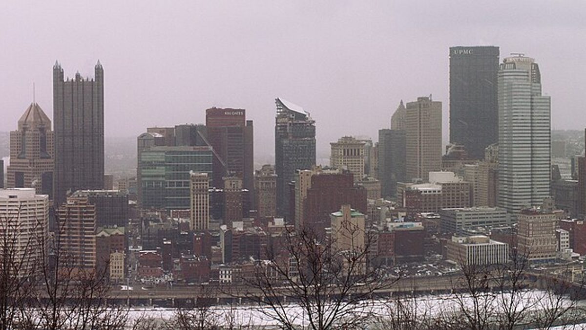
Pittsburgh sits at 1,119 feet on the western slope of the Alleghenies, far enough inland that Atlantic coastal storms usually pass to its south and east, and far enough from Lake Erie that the heavy snowbelt bands stop short of the city. That geography is why Pittsburgh is unusually sensitive to which way the winter storm track sets up.
What is the Pittsburgh winter forecast for 2026-2027?
There is no official Pittsburgh snowfall forecast for 2026-2027, and there will not be one. NOAA's Climate Prediction Center issues seasonal temperature and precipitation probabilities, never seasonal snow totals for a city. Its headline winter outlook lands in mid-October 2026, roughly seven weeks from now.
What NOAA has already published, on 13 August 2026, is the ENSO picture that will drive the season. That document is specific, it is quotable, and it matters far more to Pittsburgh than any almanac page. The next update is scheduled for 10 September 2026.
Is 2026-2027 an El Niño winter?
Yes, and an exceptional one. The Climate Prediction Center's 13 August 2026 discussion carries an El Niño Advisory and states there is a "greater than 90% chance of a very strong event during the Northern Hemisphere fall and winter 2026-27". July sea surface anomalies hit +2.9°C in the Niño-1+2 region.
The stronger claim is the one worth reading twice. For October to December 2026, CPC puts a 69% chance on "a historic event that would exceed the strength of previous El Niño events dating back to 1950", defined as a three-month RONI value of +2.5°C or more. That would make this the strongest El Niño in the instrumental record.
CPC adds its own caution in the same paragraph: with an event of this magnitude "the chances of experiencing impacts consistent with El Niño are larger, but they are not guaranteed". Hold on to that sentence. It is the difference between a tendency and a promise.
What does a strong El Niño mean for Pittsburgh snow?
Historically it has meant less snow and a warmer winter. Across the nine winters NOAA's index classes as strong or very strong El Niño events, Pittsburgh averaged 31.2 inches of snow against a long-term mean of 42.9 inches. Eight of those nine finished below normal.
Here is every one of them, with the airport's own measured total. The ONI peak is the highest three-month value the event reached, which is how NOAA classifies event strength.
| Winter | ONI peak | Class | Pittsburgh snowfall | vs 44.1" normal | Dec-Feb temp |
|---|---|---|---|---|---|
| 1957-58 | +1.81 | Strong | 37.0" | Below | 28.5°F |
| 1965-66 | +1.98 | Strong | 48.0" | Above | 30.3°F |
| 1972-73 | +2.12 | Strong | 26.3" | Below | 31.9°F |
| 1982-83 | +2.23 | Very strong | 30.1" | Below | 34.1°F |
| 1987-88 | +1.70 | Strong | 35.1" | Below | 30.2°F |
| 1991-92 | +1.71 | Strong | 33.9" | Below | 33.4°F |
| 1997-98 | +2.40 | Very strong | 24.2" | Below | 36.3°F |
| 2015-16 | +2.75 | Very strong | 29.6" | Below | 34.9°F |
| 2023-24 | +2.06 | Strong | 16.3" | Below | 38.4°F |
Narrow it to the three very strong events, the closest analogues to what NOAA now expects, and the pattern tightens: 30.1, 24.2 and 29.6 inches. All three below normal, averaging 28.0 inches. That is roughly a third less snow than a typical Pittsburgh winter delivers.
Temperature moves the same way. Those nine winters averaged 33.1°F from December through February against a 30.4°F long-term mean, so about 2.7°F warmer. The National Weather Service office in Cleveland, which covers northwest Pennsylvania, puts the mechanism plainly: a strong El Niño "commonly brings warm and dry winters to the Ohio Valley and Great Lakes regions".
The reason is the storm track. El Niño energises the southern branch of the jet stream, which is why California and the Gulf coast get soaked. Those storms ride from Texas toward the Carolinas and out to sea, passing south and east of Pittsburgh. The city ends up on the dry, mild side of the action. Our national record of 36 US cities shows the same split repeating across the Ohio Valley.
How much snow does Pittsburgh get in a normal winter?
44.1 inches. That is the official 1991-2020 seasonal normal for Pittsburgh International Airport, published by NOAA's National Centers for Environmental Information. Measured across the longer 1950 to 2026 record the average is 42.9 inches and the median is 40.8 inches, so a genuinely typical Pittsburgh winter lands near 41.
The gap between the mean and the median matters. A handful of enormous winters drag the average up, which is why "average" overstates what most winters actually feel like. More than half of all Pittsburgh winters since 1950 came in under 41 inches.
What month does Pittsburgh get the most snow?
January, by a clear margin. The official monthly normals for Pittsburgh International Airport run October 0.4 inches, November 2.4, December 7.7, January 13.3, February 11.7, March 7.6 and April 1.0. January and February together supply 25.0 of the 44.1 inch seasonal normal, or roughly 57 percent.
Advertisement
That concentration is useful if you are booking travel. A trip in early December or late March carries meaningfully less snow risk than the same trip in the third week of January.
When does it start snowing in Pittsburgh?
Usually November. Across the last 31 complete seasons the first measurable snowfall arrived in November 20 times, in October 4 times and in December 7 times. The earliest first flakes on record in that stretch fell on 25 October. Accumulating snow before Thanksgiving is common but rarely amounts to much.
November's 2.4 inch normal tells the story: snow shows up, then melts within a day or two. Ground that holds snow through the night generally arrives with December.
When does it stop snowing in Pittsburgh?
Later than most visitors expect. In 18 of the last 31 seasons the final measurable snow of the year fell in April, and in the other 13 it fell in March. The latest measurable snowfall in that record came on 27 April 2005. April's normal is only 1.0 inch, but it is not zero.
Anyone planning an early spring trip to Pittsburgh should treat late March and the first half of April as shoulder season for winter weather rather than safely past it.
How many days a year does it snow in Pittsburgh?
Snow falls on 38.9 days in an average season, but most of those days are dustings. Only 14.3 days a year bring an inch or more, 3.2 days bring three inches or more, and a six-inch day happens roughly once every two winters. The airport reports snow on the ground on 39.1 days.
This is the single most misunderstood number in Pittsburgh winters. The city gets frequent snow and rare big snow. Residents describe winter as long and grey rather than deep, and the daily record backs them up.
What was Pittsburgh's snowiest winter ever?
1950-51, with 82.0 inches, nearly double a normal season. The rest of the top five are 2009-10 at 77.4 inches, 1993-94 at 76.8, 1960-61 at 76.0 and 1995-96 at 74.5. Four of those five landed before 1996, which is part of a broader downward drift in Pittsburgh snowfall.
2009-10 is the one to remember for this winter, and it is covered further down, because it is the counterexample that stops the El Niño pattern from being a rule.
What was Pittsburgh's least snowy winter?
2023-24, with 16.3 inches. That is the lowest seasonal total in the 73 complete winters on record, and it happened during a strong El Niño with an ONI peak of +2.06. December through February that year averaged 38.4°F in Pittsburgh, the warmest winter in the whole series.
The next four lowest are 1973-74 at 16.6 inches, 1990-91 at 17.2, 2022-23 at 17.6 and 2019-20 at 21.7. Nothing about 2023-24 proves this winter will repeat it, but it is the most recent strong El Niño and it produced the emptiest winter Pittsburgh has ever measured.
How much snow did Pittsburgh get last winter?
51.6 inches in 2025-26, comfortably above the 44.1 inch normal and the snowiest season since 2020-21. It included an 11.2 inch calendar day on 25 January 2026, the second biggest single-day snowfall Pittsburgh has recorded since 1995. Eleven separate days brought an inch or more.
Two winters before that, the city managed 16.3 inches. Pittsburgh's recent run reads 57.7, 44.8, 17.6, 16.3, 34.0 and 51.6 inches. Consecutive winters here have almost nothing to do with each other, which is exactly why last season is a poor guide to this one.
What does the Farmers' Almanac say about Pennsylvania winter 2026-2027?
The Farmers' Almanac calls the Northeast "one of the season's most complicated winter patterns" and predicts that inland areas "could face several rounds of heavy, wet snow" during January and February. For the Great Lakes and Ohio Valley it forecasts near-normal temperatures with fast-moving clippers and brief snowy periods.
Pittsburgh sits awkwardly across both regions, which is the first problem. The second is that the Almanac publishes no inch totals and no verification record, and its own methodology page credits a proprietary formula in use since 1818. It does acknowledge El Niño as an influence this year.
Set that against the measured record above and the tension is obvious. The Almanac is calling for repeated heavy wet snow inland during exactly the two months when strong El Niño winters have historically starved Pittsburgh. We looked at how these two forecasting traditions disagree in our comparison of the almanacs against the science.
What does the Old Farmer's Almanac say about Pittsburgh?
Less than it appears to. Its Pittsburgh page does not forecast Pittsburgh at all; the panel is headed "Long Range Weather Forecast for Ohio Valley", a region stretching from western Pennsylvania to Illinois. Checked on 25 August 2026, its twelve-month outlook was still labelled November 2025 to October 2026.
That heading is last winter's forecast, not this one. The Old Farmer's Almanac releases its new edition in late summer, so the 2026-2027 outlook should replace it within weeks. Until it does, any article quoting "colder than normal, snowfall near to above normal in the east and below west" as the 2026-2027 Pittsburgh forecast is quoting the 2025-2026 one.
Several pages ranking for this exact search are doing precisely that right now. It is worth checking the date stamp on any almanac quote you read this month before acting on it.
Does Pittsburgh get lake effect snow?
Only the tail end of it. Pittsburgh lies roughly 100 miles south of Lake Erie, well outside the primary snowbelt that buries Erie, Ashtabula and the ridges east of Cleveland. Northwest winds behind a cold front occasionally push lake-enhanced flurries into Allegheny County, generally producing an inch or two.
The difference is stark within Pennsylvania. Erie's seasonal normal is 104.3 inches against Pittsburgh's 44.1, and Erie cleared 100 inches in 13 of its last 25 complete seasons. If you are comparing cities across the state, our Pennsylvania snow record page breaks down Erie, Philadelphia, Scranton, State College and Harrisburg side by side.
When will NOAA release the official winter outlook?
Mid-October 2026. The Climate Prediction Center issues its headline seasonal outlook for December through February then, having already updated the underlying probability maps every month through the summer. The next ENSO diagnostic discussion, which drives the whole picture, is scheduled for 10 September 2026.
Advertisement
Even that October release will not contain a Pittsburgh snowfall number. It gives probabilities of above, near or below normal temperature and precipitation across broad regions. Snow is not one of the variables, because seasonal snow depends on storm timing that no model resolves months ahead.
What to do with this before winter
The record does not tell you what to expect on any given day, but it does tell you where to put your effort. These five steps are what the numbers actually support, in the order they matter for someone travelling to or through Pittsburgh this season.
- Treat mid-January to mid-February as the risk window. It carries 57 percent of the seasonal normal, and a strong El Niño does not change when the snow falls, only how much.
- Do not plan around a light winter. Eight of nine strong El Niño winters were below normal, but 1965-66 was not, and one big storm still closes the Parkway regardless of the seasonal total.
- Check the CPC outlook in mid-October rather than an almanac in August. It is free, it is dated, and it states its own confidence.
- For driving, bookmark 511PA before you need it. Pittsburgh's hills and bridges ice ahead of flat ground, and the city closes specific steep streets during storms.
- For flying, watch de-icing delays rather than cancellations at Pittsburgh International. The airport rarely closes, but a three-inch morning reliably ripples through departure times.
What this record cannot tell you
Nine winters is a small sample, and this page is a description of what happened, not a forecast of what will. Two specific caveats deserve stating rather than burying, because both cut against the tidy story the numbers above appear to tell.
The first is 2009-10. Pittsburgh recorded 77.4 inches that season, the second snowiest in the entire record, during an El Niño that NOAA classifies as moderate. The seven moderate El Niño winters averaged 47.3 inches, above normal, not below. The relationship weakens fast once you step outside the strong events.
The second is the index itself. The historical classification above uses the Oceanic Niño Index, while CPC's headline 2026-2027 number is a RONI value, a different measure that adjusts for warming across the wider tropics. The two are not interchangeable, and comparing this event's RONI forecast against past ONI rankings is not a like-for-like match.
Three seasons were dropped from the 73-winter series because the airport's daily record has missing days: 2004-05, 2010-11 and 2012-13. Every figure on this page comes from Pittsburgh International Airport, station USW00094823. Neighbourhoods in the higher eastern and southern suburbs routinely out-measure the airport.
Common questions
Will it snow in Pittsburgh on Christmas?
Less often than the postcards suggest. Pittsburgh had an inch or more of snow on the ground on 25 December in 8 of the last 31 years, about one Christmas in four. Strong El Niño Decembers skewed mild: the airport measured bare ground on Christmas Day in both 2015 and 2023.
Is Pittsburgh getting less snow than it used to?
The record leans that way. Four of Pittsburgh's five snowiest winters happened before 1996, and three of the five least snowy have occurred since 2019. This tracks the broader warming signal, though single seasons like 2025-26 at 51.6 inches show the trend is a slope, not a staircase.
Is Pittsburgh hard to drive in during winter?
Harder than the snowfall total implies. The city's terrain is the issue rather than the depth: steep grades, narrow streets and more than 400 bridges that freeze before road surfaces do. Two inches on a Pittsburgh hillside creates problems that six inches on flat ground would not.
Do flights get cancelled at Pittsburgh International in winter?
Delays are far more common than cancellations. Pittsburgh International handles snow routinely and rarely shuts, but de-icing queues on snowy mornings push departures back by an hour or more. Build a longer connection buffer for January and February mornings than you would for other months.
How does Pittsburgh compare with the rest of Pennsylvania?
It sits in the middle. The 1991-2020 seasonal normals put Erie at 104.3 inches thanks to Lake Erie, Philadelphia at 23.1, and Pittsburgh at 44.1 between them. Within the western half of the state, the Laurel Highlands southeast of the city collect substantially more snow than the airport does.
Where can I read the underlying NOAA data myself?
All of it is public. The NWS Pittsburgh climate page holds the local record, NOAA's US Climate Normals publishes the 1991-2020 figures, and the CPC discussion linked below carries the ENSO forecast. No subscription is needed for any of them.
Sources
Seasonal and daily snowfall for Pittsburgh International Airport was pulled from the NOAA Regional Climate Centers ACIS database, the same source behind the National Weather Service's own climate tools, covering 1 July 1950 to 30 June 2026. The forecast material comes from NOAA and from the two almanacs directly.
- NOAA Climate Prediction Center, ENSO Diagnostic Discussion, 13 August 2026
- CPC ENSO evolution, status and forecasts briefing
- CPC seasonal temperature and precipitation outlooks
- NOAA NCEI, US Climate Normals 1991-2020
- National Weather Service Pittsburgh, climate records
- National Weather Service Pittsburgh, winter weather
- National Weather Service Cleveland, winter 2023-24 climate summary
- Farmers' Almanac 2026-2027 winter forecast
- Old Farmer's Almanac long-range forecast for Pittsburgh
More winter records for other states sit in our weather for traveling section.
Topics
Advertisement