Snow Predictions For Maryland 2026-2027

Maryland averages 19.3 inches of snow a season, but Oakland gets 104.9. NOAA records, what El Nino really means here, and why no map can give a total.
Advertisement
Maryland averages 19.3 inches (49 cm) of snow a season at Baltimore, and 104.9 inches (266 cm) in Garrett County, 150 miles apart in the same state. A strong El Nino is forecast for 2026-2027, and the record says that is not a snow guarantee. It produced Baltimore's biggest winters and its emptiest ones.
This is a research guide built from National Weather Service station records and official NOAA outlooks, pulled on 7 August 2026. We have not spent a winter in Maryland ourselves, so every number below is sourced and dated rather than remembered.
Will it snow in Maryland this year?
Yes. Snow falls somewhere in Maryland every winter, and the only real question is how much and where. Baltimore's 30-year normal is 19.3 inches (49 cm) a season. Oakland, in the far west, normals 104.9 inches (266 cm). Assateague Island on the coast normals 3.4 inches (9 cm).
Nobody can tell you Maryland's seasonal total for 2026-2027 in August, and anybody printing a number for it is guessing. That is not us being cautious. NOAA's Climate Prediction Center, which is the agency that issues the official US seasonal outlooks, does not publish a seasonal snowfall forecast at all. Its 90-day outlooks cover temperature and precipitation probabilities only.
What you can know in advance is the climate record, which is the rest of this page.
How much snow does Maryland get on average?
Between 3 and 105 inches, depending entirely on how far west you are. Maryland climbs from sea level on the Eastern Shore to the Allegheny plateau at over 3,000 feet (900 m) in Garrett County, and snowfall climbs with it. These are the 1991 to 2020 NOAA normals, the current official 30-year averages:
| Place | Region | Average season snowfall |
|---|---|---|
| Oakland | Garrett County (far west) | 104.9 in / 266 cm |
| Frostburg | Allegany County | 72.1 in / 183 cm |
| Cumberland | Allegany County | 28.7 in / 73 cm |
| Baltimore (BWI) | Central | 19.3 in / 49 cm |
| Chestertown | Upper Eastern Shore | 16.7 in / 42 cm |
| Beltsville | DC suburbs | 15.8 in / 40 cm |
| Mechanicsville | Southern Maryland | 15.1 in / 38 cm |
| Royal Oak | Mid Eastern Shore | 14.1 in / 36 cm |
| Patuxent River | Chesapeake shoreline | 12.5 in / 32 cm |
| Snow Hill | Lower Eastern Shore | 10.2 in / 26 cm |
| Salisbury | Lower Eastern Shore | 8.0 in / 20 cm |
| Assateague Island | Atlantic coast | 3.4 in / 9 cm |
Source: NOAA National Centers for Environmental Information, 1991 to 2020 station normals.
Oakland gets more than five times Baltimore's snow and roughly thirty times Assateague's. Treating "Maryland snow" as one number is the single biggest mistake in every guide that ranks for this question.
Does it snow in Maryland every year?
Yes, every year, but not in useful amounts every year, and not in every county. Here is how little that 19.3-inch average tells you: in 2009-10 Baltimore recorded 77.0 inches, and in 2022-23 it recorded 0.2 inches, the least of any season since records began in 1883. Those are thirteen years apart, at the same airport.
The average describes the long run. It does not describe any winter you will actually experience.
Maryland winters are feast or famine, and the swing is wider than almost any climate table makes it look.
Which months does it snow in Maryland?
January and February, overwhelmingly. Those two months carry 72 percent of Baltimore's seasonal snow between them. Here is the month-by-month split of the 19.3-inch normal at BWI:
| Month | Normal snowfall at BWI | Share of the season |
|---|---|---|
| October | 0.0 in / 0 cm | 0% |
| November | 0.1 in / 0.3 cm | 1% |
| December | 2.5 in / 6 cm | 13% |
| January | 6.4 in / 16 cm | 33% |
| February | 7.5 in / 19 cm | 39% |
| March | 2.8 in / 7 cm | 15% |
| April | 0.0 in / 0 cm | 0% |
Source: NOAA 1991 to 2020 normals for Baltimore/Washington International Thurgood Marshall Airport. The months sum to 19.3 inches, which matches the NCEI seasonal normal for Baltimore exactly.
February is Baltimore's snowiest month, not January, and that surprises most people. If you are choosing when to visit for snow, the second half of January through February is the window. November is effectively empty.
Does it snow in Maryland in December and at Christmas?
Rarely enough that you should not plan around it. December normals 2.5 inches (6 cm) at Baltimore, which is 13 percent of the season, and a normal that small is usually delivered by one modest event rather than spread across the month.
A white Christmas in Baltimore, Annapolis or the DC suburbs is a genuine long shot. Garrett County is a different story: with 104.9 inches (266 cm) across the season and elevation above 2,500 feet, snow on the ground in late December there is common rather than lucky.
Book the mountains if December snow is the point of the trip. Do not book Baltimore for it.
Does it snow a lot in Baltimore?
No, not by American standards. Baltimore's 19.3 inches (49 cm) is less than Boston, Chicago or Denver, and the city goes entire winters with no storm bigger than a few inches. What Baltimore does have is a tail: when the Mid-Atlantic sets up right, it gets buried.
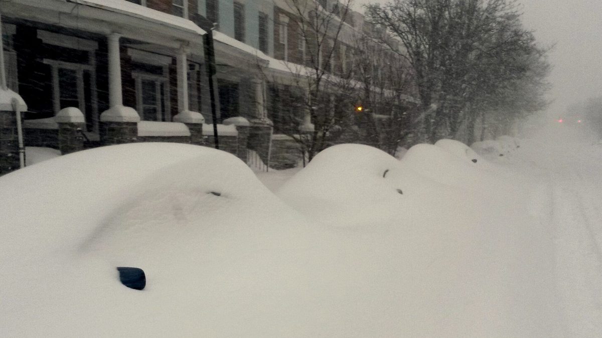
The record season, 2009-2010, delivered 77.0 inches (196 cm) at BWI, which is four times the normal. Washington DC recorded 56.1 inches (142 cm) that same winter, according to the National Weather Service.
Then look at what came after. Across the fifteen completed seasons from 2010-11 to 2024-25, BWI beat its own 19.3-inch normal only three times, in 2013-14, 2014-15 and 2015-16. Every season from 2016-17 onward has finished below normal, nine in a row, two of them under 2 inches.
Advertisement
Whatever you were told about Maryland winters, the recent record is drier than the average implies.
So the honest description of Baltimore is not "snowy" or "not snowy". It is low-frequency, high-impact. Most winters underdeliver, and once or twice a decade the city gets a storm that shuts it down for a week.
How much snow does western Maryland get?
Oakland, the Garrett County seat, normals 104.9 inches (266 cm) a season, which is more than Buffalo's reputation suggests and more than most of New England. Frostburg normals 72.1 inches (183 cm). Cumberland, only 25 miles east of Frostburg but 1,500 feet lower, drops to 28.7 inches (73 cm).
That collapse over 25 miles is the whole geography of Maryland snow in one comparison. Elevation, not latitude, is what decides it here.
Garrett County sits on the Allegheny plateau and catches upslope snow from the same northwest flow that feeds the Great Lakes snow belts. It snows there on days when Baltimore is dry and 15 degrees warmer.
What does El Nino mean for Maryland snow in 2026-2027?
It raises the odds of a big winter and the odds of an empty one at the same time. That sounds evasive. It is what the record actually shows, and it is the single most misreported fact in this whole topic.
First, the current state of the forecast, from the primary source. The Climate Prediction Center's ENSO Diagnostic Discussion issued 9 July 2026 has an El Nino Advisory in effect, with the latest weekly Nino-3.4 index at +1.2 degrees C. CPC gives a 97 percent chance El Nino persists through early spring 2027, and an 81 percent chance of a very strong El Nino during October to December, which would rank among the largest events since records began in 1950.
Now the part the forecast maps leave out. The National Weather Service office that covers Baltimore and Washington studied every El Nino winter since 1950 and found this:
"Of the seven strong El Nino winters since 1950, four have been associated with well above normal snowfall while snowfall was virtually absent in the other three winters."
National Weather Service Baltimore/Washington
Four out of seven. That is a coin flip with a fat tail on both ends, not a forecast.
We took CPC's own Oceanic Nino Index table, pulled every winter since 1950 that reached +1.5 or higher, and set each one against the actual seasonal snowfall at BWI from the National Weather Service's Baltimore record. There are eight. As far as we can find, nobody presents these two datasets side by side:
| Winter | DJF Nino index | BWI seasonal snowfall | vs the 19.3 in normal |
|---|---|---|---|
| 1957-58 | +1.7 | 43.0 in / 109 cm | More than double |
| 1972-73 | +1.6 | 1.2 in / 3 cm | Almost nothing |
| 1982-83 | +2.1 | 35.6 in / 90 cm | Nearly double |
| 1991-92 | +1.5 | 4.1 in / 10 cm | A fifth of normal |
| 1997-98 | +2.2 | 3.2 in / 8 cm | A sixth of normal |
| 2009-10 | +1.5 | 77.0 in / 196 cm | The all-time record |
| 2015-16 | +2.5 | 35.1 in / 89 cm | Nearly double |
| 2023-24 | +1.8 | 11.3 in / 29 cm | Below normal |
Sources: CPC Oceanic Nino Index (ERSST v6) and the National Weather Service Baltimore/Washington BWI snowfall record, 1883 to present. Both pulled 7 August 2026. NWS labels its own page preliminary and points to NCEI for certified data.
Four of the eight came in well above normal. Four came in well below. That is the NWS finding, and adding the 2023-24 winter it did not cover leaves the split exactly where it was.
Now read the two strongest events in the table against each other, because they settle the argument on their own. 1997-98 carried a +2.2 index and produced 3.2 inches all season. 2015-16 carried a +2.5 index and produced 35.1 inches. The stronger of the two was the emptier of the two.
And the single snowiest winter in Baltimore's 140-year record, 2009-10 at 77.0 inches, sits at +1.5, the weakest El Nino on the list.
Same signal, opposite outcomes.
The reason is a second pattern that almost no seasonal forecast page mentions: the North Atlantic Oscillation. The same NWS office found the NAO is the stronger predictor of local snow, that above-normal snow clusters in neutral-to-negative NAO winters, and that only one winter since 1950 produced above-normal snow while the NAO was positive. The record 2009-2010 season came from a moderately strong El Nino combined with a strongly negative NAO.
The NAO cannot be forecast months ahead. It is predictable roughly two weeks out. So a page telling you in August what Maryland's snowfall will be in February is claiming a skill that does not exist in the science.
What do the Maryland snow prediction maps for 2026-2027 actually show?
Almost none of them show snow. This is worth understanding before you trust one.
- CPC seasonal outlooks show the probability of temperature and precipitation being above, near or below normal. Precipitation includes rain. A "wetter than normal" Maryland in a mild winter means rain, not snow. CPC issues these monthly, and its headline Winter Outlook lands in mid-October, not in summer.
- Almanac maps print specific snowfall totals and dates months ahead. No published, peer-reviewed skill score supports that, and no meteorological agency issues forecasts in that form.
- Model charts (ECMWF, CFSv2) show anomalies in pressure and temperature fields, which is a genuine input, and not a snowfall total for your county.
If a 2026-2027 map gives you an inches figure for Maryland, that number was not produced by a forecast system capable of producing it. We are a travel site, not a forecast office, and we are not going to invent one either.
Advertisement
When will it snow in Maryland this winter?
The climatological answer is the only honest one this far out: expect the first measurable snow in central Maryland around December, the meaningful accumulations in the second half of January and February, and the last chance in mid-March.
For an actual date, forecasts have real skill at about seven days and useful skill at ten to fourteen. Check the NWS Baltimore/Washington office (weather.gov/lwx) inside that window and ignore anything longer.
If you are booking travel, book for the season and accept the roll of the dice. If your trip depends on snow being on the ground, that is what Garrett County is for.
Where can you see snow in Maryland?
Garrett County, in the far western corner, and realistically nowhere else with any reliability. The county holds Deep Creek Lake, Maryland's largest lake, and Wisp Resort on Marsh Mountain, which the resort describes as the state's only ski area, with a summit around 3,115 feet (950 m).
Practical notes for a snow trip:
- Garrett County is a three-hour drive from Baltimore and roughly three from Washington DC. It is not a day trip.
- Wisp Resort sits at 296 Marsh Hill Road, McHenry, and runs year round. Its 2026-2027 opening date and lift prices were not published on wispresort.com when we checked on 7 August 2026, so we are not printing a figure. Check the resort's own site before you book, and expect the season to depend on snowmaking as much as snowfall.
- Deep Creek Lake State Park and New Germany State Park keep winter trails. Maryland's park system publishes conditions each season at dnr.maryland.gov.
- Mountain roads in Garrett County get closed and drifted. Check the Maryland 511 traveller information service before you drive, every time.
Our recommendation, stated plainly: if seeing snow is the reason for the trip, go to Garrett County or do not come to Maryland for snow at all. Baltimore, Annapolis and the DC suburbs are a bad bet in any single winter, and a 19-inch seasonal normal spread over three months is not a snow holiday.
What was Maryland's snowiest winter on record?
2009-2010, at least for Baltimore, with 77 inches (196 cm) recorded at BWI against a normal of 19.3. That season included the storms remembered as Snowmageddon, and the National Weather Service recorded 56.1 inches (142 cm) in Washington DC the same winter.
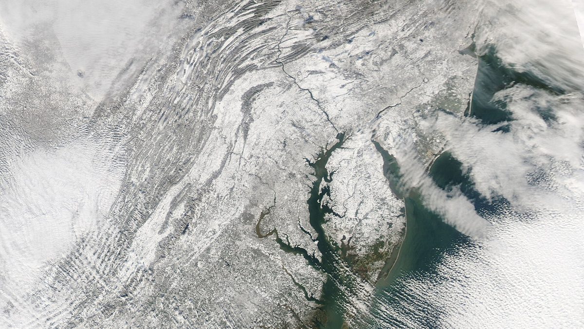
It came from a moderately strong El Nino paired with a strongly negative NAO, which is the combination the NWS itself calls unique in its records. It is the exact pattern nobody can promise you in advance, and the reason "El Nino means snow" keeps getting repeated even though the record says it means variance.
The other end of the same record is just as instructive. Baltimore's least snowy season since 1883 is 2022-23, at 0.2 inches, half a centimetre for an entire winter. It happened three years ago, not in some distant decade.
Visiting from the UK or Europe?
Three things translate badly and are worth setting straight.
Maryland measures snow in inches, and reports depth per storm, not per season, on the news. The 19.3-inch seasonal normal for Baltimore is 49 cm, which is more than most of England sees but far less than the Alps, and it arrives in two or three events rather than steadily.
Temperatures are in Fahrenheit. Baltimore winters sit around freezing rather than well below it, which is why so much of what falls turns to slush by the next afternoon.
And the distances are American. Garrett County looks close to Baltimore on a map of a small state. It is a three-hour drive across a mountain range, and in a snow event it is longer. Hire a car with that in mind, and do not plan Baltimore in the morning and skiing in the afternoon.
Sources, and when we checked them
- NOAA National Centers for Environmental Information, 1991 to 2020 station snowfall normals for Maryland. Checked 7 August 2026.
- National Weather Service Baltimore/Washington, BWI season-by-season snowfall record, 1883-84 to present, including the 1991 to 2020 monthly normals. Checked 7 August 2026. NWS marks this table preliminary and points to NCEI for certified figures.
- NOAA Climate Prediction Center, ENSO Diagnostic Discussion issued 9 July 2026, and the Oceanic Nino Index table (ERSST v6). Checked 7 August 2026.
- NOAA Climate Prediction Center long-range seasonal outlooks, issued monthly. Checked 7 August 2026.
- National Weather Service Baltimore/Washington: El Nino and winter snowfall research, and the ENSO and NAO versus local winter snowfall study. Checked 7 August 2026.
- Wisp Resort official site, checked 7 August 2026 for 2026-2027 season dates and pricing. Neither was published at that time.
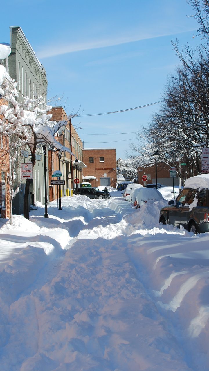
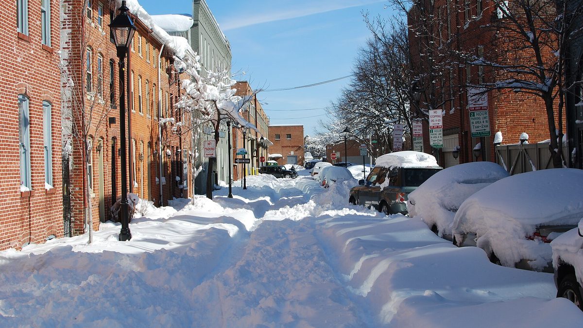
Cover photograph: Lancaster Street, Fells Point, Baltimore, 7 February 2010, by Laura Swiecicki, CC BY 2.0. In-article photograph of Howard Street by Seth Sawyers, CC BY 2.0. Satellite image by the NASA MODIS Rapid Response Team, public domain.
Winter conditions and outlooks change. Check weather.gov/lwx and Maryland 511 before you travel, and confirm resort and park opening dates on their official sites before you book.
Related guides: Virginia snow predictions for 2026-2027 covers the state directly south with the same El Nino question. Tennessee snow predictions and Georgia snow predictions show how fast the numbers fall away further south, and where to see snow near Atlanta is the drive-to-snow version of the Garrett County question.
Topics
Frequently asked questions
Advertisement