Snow Predictions For Tennessee 2026-2027

Tennessee snowfall runs from 2.7 inches at Memphis to 9.2 at Bristol, with feet in the high Smokies. Official NOAA normals, the record storms, and what every 2026-2027 forecast really says.
Advertisement
Snow predictions for Tennessee start with geography, not a forecast. Bristol in the northeast averages 9.2 inches a season, Nashville 4.7, and Memphis in the west just 2.7, on the official 1991-2020 records. For 2026-2027 the NOAA Climate Prediction Center favours a wetter-than-normal winter across the state under a strengthening El Nino, but wetter does not reliably mean snowier.
This is a research guide built from National Weather Service station records and official NOAA outlooks. We have not spent a winter in the Tennessee mountains ourselves, so every number here is sourced and dated rather than remembered.
Snow Predictions For Tennessee 2026 2027
No official body forecasts how many inches Tennessee will get. NOAA's Climate Prediction Center issues probability outlooks for temperature and precipitation only, and states plainly that its winter outlook does not project seasonal snowfall totals, because snow is not predictable more than about a week ahead.
Here is what CPC did publish for December to February 2026-2027, from its seasonal discussion issued 16 July 2026. Tennessee straddles two of CPC's zones, the Southeast and the Ohio Valley:
- Temperature: near-normal favoured across the Southeast, with roughly 33 to 40 percent odds on the near-normal band. Not a cold-winter call, not a mild one.
- Precipitation: above-normal favoured across the southern tier, with some of the highest probabilities in the country over the Southeast.
- El Nino: a 97 percent chance it lasts into early spring 2027, and an 81 percent chance it is strong during October to December 2026.
The catch is the one every almanac-driven page misses. A strong El Nino sends more moisture across Tennessee, but it also cuts the number of hard Arctic outbreaks, and snow needs cold and moisture on the same day. More rain is close to a sure thing. More snow is not.
All month snow prediction in Tennessee
Snow falls in Tennessee from November through March, and effectively never outside that window. January is the peak statewide, carrying more than a third of the season's snow on its own. These are the official 1991-2020 monthly normals for Nashville and Knoxville, the two cities with the most complete records:
| Month | Nashville | Knoxville | Notes |
|---|---|---|---|
| November | 0.1" | 0.1" | Rare, usually a flurry |
| December | 0.5" | 0.5" | Possible, often none |
| January | 1.8" | 1.7" | The snowiest month |
| February | 1.6" | 1.3" | Second, and often the biggest storms |
| March | 0.6" | 0.7" | Fading, but the record storms hit in March |
| April to October | 0.0" | 0.0" | Done |
Nashville records measurable snow on about 5 days a year, Knoxville on about 4, counted from the 1991-2020 daily record. Do not read March's small number as safe: Tennessee's two biggest snow events on record both landed in March.
Tennessee snowfall city by city
Where you are in Tennessee matters more than which winter it is. Snowfall climbs from almost nothing in the west to nearly a foot a season in the northeastern hills, and far more in the Smokies. These are the official NOAA 1991-2020 seasonal normals:
| City | Region | Seasonal normal |
|---|---|---|
| Bristol / Tri-Cities | Northeast hills, 1,496 ft | 9.2" |
| Nashville | Middle Tennessee | 4.7" |
| Knoxville | East Tennessee valley | 4.6" |
| Chattanooga | Southeast | 3.6" |
| Memphis | West Tennessee | 2.7" |
Bristol gets more than three times the snow of Memphis, and it is not close. If a page quotes Memphis or Nashville at 6 or 8 inches, check the source: those figures do not match the published NOAA normals. The high Smokies are a different world again, covered further down.
What every winter forecast says for 2026-2027
Most of the winter forecasts quoted for Tennessee right now have not actually been published, and one of them never will be. As of late July 2026, only NOAA has issued anything covering the 2026-2027 season. Here is the honest state of every major source, before you trust a number you find elsewhere:
Advertisement
| Forecaster | 2026-2027 status | What it says |
|---|---|---|
| NOAA Climate Prediction Center | Published 16 July 2026 | Near-normal temperatures, above-normal precipitation for the region. No snowfall total, by policy |
| Old Farmer's Almanac | Not yet published | Its US winter forecast normally appears in August |
| Farmers' Almanac | Will never publish one | The publication closed after 208 years. Its notice: "The 2026 Farmers' Almanac will be our last edition" |
| AccuWeather | Not yet published | Last year's US winter forecast appeared in October |
Two warnings if you are reading other sites. The Farmers' Almanac has shut down, confirmed by Popular Science and the Washington Post in November 2025, so any "Farmers' Almanac 2026-2027" Tennessee forecast is quoting something that does not exist. It is a different publication from the Old Farmer's Almanac, which is still going.
And the almanacs are not accurate enough to plan around. A peer-reviewed test in Weatherwise scored their monthly forecasts at close to a coin flip, 50.7 percent for temperature and 51.9 for precipitation, and a 2010 university review found essentially zero skill. Last winter is the local proof: for 2025-2026 the almanacs leaned cold and snowy for the region, and Nashville finished with 1.4 inches against a 4.7 normal while the season ran slightly warmer than normal. We went deeper into that record in our piece on the two sides of the winter forecast.
Tennessee snowfall records
Tennessee's snow records live in two places: the deep valley snows of the past and the extraordinary totals of the high Smokies. The state 24-hour record is 30 inches at Mount LeConte on 14 March 1993, during the Storm of the Century, per NOAA's climate-extremes record.
Each major city's single greatest calendar-day snowfall, from the official station record:
| City | Biggest day ever | Date |
|---|---|---|
| Knoxville | 17.5" | 13 February 1960 |
| Chattanooga | 18.5" | 13 March 1993 |
| Tri-Cities / Bristol | 16.2" | 21 November 1952 |
| Memphis | 14.3" | 22 December 1963 |
| Nashville | 8.2" | 22 March 1968 |
The March 1993 Superstorm is the benchmark for the eastern half of the state. It dropped roughly 60 inches on Mount LeConte, a two-day total of 20 inches on Chattanooga, its all-time biggest, and 14 to 15 inches on Knoxville and the Tri-Cities. In Middle Tennessee, Nashville's largest storm on record is older still, 17.3 inches in March 1892.
More recently, the January 2025 Gulf storm gave Memphis 7.5 inches in a day, its biggest single-day snow in about 40 years, a reminder that West Tennessee's rare snows can still be large.
Snowfall in Tennessee year by year
Season totals at Nashville and Knoxville, summed straight from the daily station record. A season runs 1 July to 30 June, so "2021-22" means the winter of early 2022. Read down the columns and the real pattern appears: snow arrives in big years and near-zero years, not on a smooth trend.
| Season | Nashville | Knoxville |
|---|---|---|
| 2010-11 | 12.5" | 12.3" |
| 2011-12 | 0.4" | 0.1" |
| 2012-13 | 1.5" | 3.8" |
| 2013-14 | 1.6" | 12.4" |
| 2014-15 | 6.1" | 9.3" |
| 2015-16 | 11.3" | 5.2" |
| 2016-17 | 2.2" | 2.3" |
| 2017-18 | 3.0" | 2.6" |
| 2018-19 | 0.5" | 2.1" |
| 2019-20 | 1.5" | 3.7" |
| 2020-21 | 5.4" | 5.3" |
| 2021-22 | 12.3" | 10.7" |
| 2022-23 | 1.2" | 1.6" |
| 2023-24 | 7.6" | 8.5" |
| 2024-25 | 6.3" | 7.5" |
| 2025-26 | 1.4" | 3.6" |
Nashville swung from 12.5 inches in 2010-11 to under half an inch the very next winter. That is what an average of 4.7 hides. Any year-by-year table that rises or falls in a smooth line is not describing Tennessee.
Last winter, 2025-2026, fit the quiet end of the pattern: one real snow event, the 23 to 25 January storm, produced almost the entire seasonal total at most stations, and Chattanooga finished with just 0.8 inches.
Advertisement
Snow in the Smoky Mountains and Gatlinburg
The Smokies are where Tennessee actually gets deep snow, and the difference from the valleys is enormous. Gatlinburg town, at about 1,292 feet, gets an inch or more of snow only one to five times a year. The high country above it is a separate climate entirely.
The National Park Service puts the contrast plainly for Great Smoky Mountains: at low elevations "snows of 1 inch or more occur 1 to 5 times a year," while in the higher mountains snow "falls more frequently and up to two feet can fall during a storm." Kuwohi, formerly Clingmans Dome, tops out at 6,643 feet, the highest point in Tennessee.
- Gatlinburg town: light, occasional snow. Do not plan a snow trip around the town itself.
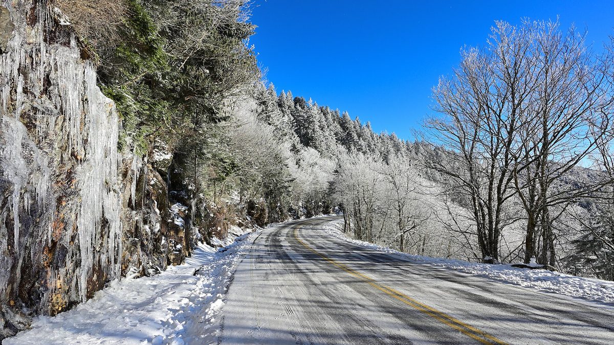
- The high Smokies: Newfound Gap and Kuwohi can hold snow for weeks and take feet of it in a single storm. Roads there close in winter weather.
- Ober Mountain, above Gatlinburg: Tennessee's only ski area, reached by tramway, running on machine-made snow. It is the one place in the state you can count on skiing.
If your goal is reliable snow-play, Ober Mountain is the answer. If it is scenery, the high Smokies in a cold snap are the most spectacular snow in the state, weather and road closures permitting.
Tips for staying safe in the snow
Tennessee snow is more often an ice-and-disruption event than a powder day, especially down in the valleys where most people live, so the practical advice here leans toward caution rather than recreation. Five things worth knowing before a Tennessee winter:
- Watch for ice, not just snow. Middle and West Tennessee often get a wintry mix, and a glaze of ice does more damage than a few inches of snow.
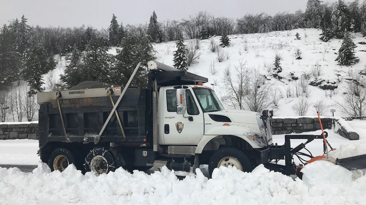
- Expect the cities to close down. Nashville and Memphis have little snow-clearing equipment, so even a light snow shuts schools and roads rather than opening them.
- Go north and go high for real snow. Bristol and the northeast hills, and above all the Smokies, are where snow is both deeper and more reliable.
- Check road status before mountain trips. Newfound Gap Road and other high routes close in winter storms with little notice.
- Aim for January. It is the snowiest month statewide, with February close behind in the mountains.
For the same treatment of nearby states this season, see our guides to snow in Georgia and Virginia and Maryland.
Sources
- NOAA Climate Prediction Center, seasonal outlook discussion (16 July 2026) and ENSO diagnostic discussion
- NWS 1991-2020 climate normals: Nashville, Knoxville, Chattanooga, Memphis, Tri-Cities
- NWS Morristown, East Tennessee snowfall records, and NWS Nashville, top Nashville snowstorms
- NWS, the March 1993 Superstorm
- National Park Service, Great Smoky Mountains weather and snow climatology
- Station snowfall totals computed from the NOAA Regional Climate Centers daily record (RCC-ACIS)
- Farmers' Almanac closure, reported by Popular Science, November 2025; almanac accuracy from Walsh and Allen, Weatherwise 1981, and Bond, University of Washington Climate, 2010
Snowfall figures are official station observations and climate normals as published in July 2026. Conditions change: check the National Weather Service forecast for your part of Tennessee before you travel.
Topics
Frequently asked questions
Advertisement