Wyoming Snow Predictions 2026-2027: El Nino Outlook and Gannett Peak's 2-Foot Storm

Don Day, OpenSnow, and NOAA on Wyoming's El Nino winter, plus this week's 2+ foot storm at Gannett Peak. Real forecasts and normals compared.
Advertisement
Wyoming snow predictions for 2026-2027 split into two different stories unfolding at the same time this October. The first is immediate: Gannett Peak, the state's highest point, could pick up more than 2 feet of snow between 10 and 14 October 2026, part of the same early-season storm that already hit Montana and is now moving into Utah. The second is bigger and messier. Every major forecaster, from a veteran Wyoming meteorologist to NOAA itself, is pointing at a historically strong El Nino for the whole 2026-2027 winter, and they do not all agree on what that means for the state. Southern Wyoming looks likely to do well. Northern Wyoming might not.
Key facts (updated 12 October 2026):
This week's storm: 10-14 October 2026, more than 2 feet possible at Gannett Peak, double-digit totals in the Wind River Range
Tetons and Jackson Hole: 2+ inches of liquid equivalent from this storm, mostly falling as snow
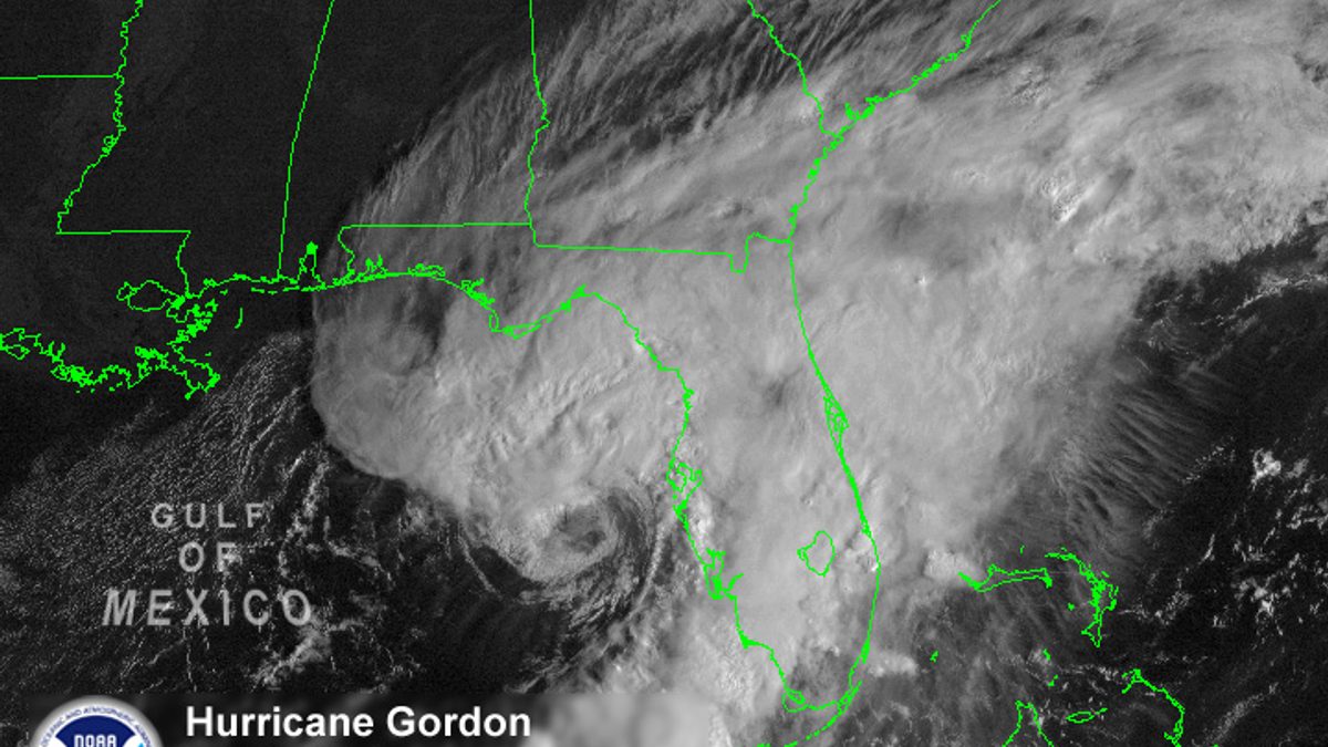
Same storm system: the Hurricane Rachel remnant and cold front already covered in our Montana and Utah guides
The bigger picture: NOAA's Climate Prediction Center puts an 83 percent chance on this El Nino reaching historic strength for October through December 2026
Don Day's call (Cowboy State Daily, 15 September 2026): adequate snow likely in southern Wyoming, a second dry winter possible in the north
OpenSnow's call: equal chances above or below normal statewide, with January and March the best shots at above-average snow
Wyoming's normal snowfall: Casper 75.4 inches a season, Cheyenne 62.9 inches (1991-2020 normals)
Cheyenne's average first snow: around 7 October, with measurable snow by the end of October in 89 percent of years
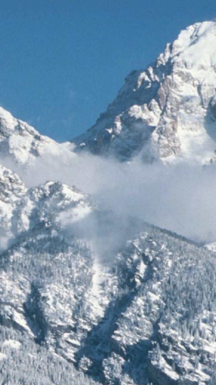
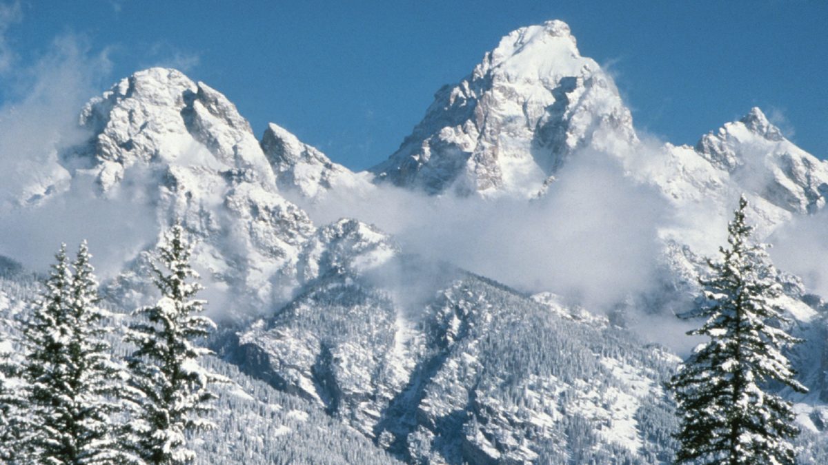
The Grand Teton in winter. Photo: National Park Service, public domain.
Will it snow in Wyoming, and how much?
More at the highest elevations than almost anywhere else in the country right now. Gannett Peak, at 13,804 feet the state's tallest mountain, could see more than 2 feet if the storm plays out as forecast. The Wind River Range is expected to pick up double-digit totals, and the Tetons and Jackson Hole area could get more than 2 inches of liquid equivalent, most of it falling as snow rather than rain given the elevation. This is one storm, not the whole winter, and it is worth keeping the two separate.
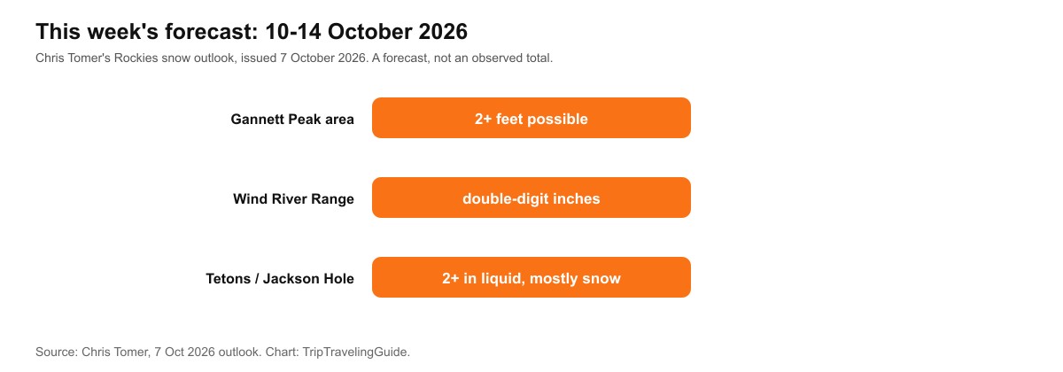
Chris Tomer's 7 October 2026 outlook for the storm's Wyoming impact. A forecast, not an observed total.
Is this the same storm that hit Montana?
Yes. Our Montana snow guide and Utah first-snow guide both cover the same system: moisture from a weakening Pacific tropical storm, Rachel, combining with a cold front to bring an unusually early round of snow across the northern and central Rockies. Wyoming sits in the middle of that path, between Montana, where the snow arrived first, and Utah, where it is forecast a few days later.
Advertisement
What do Wyoming's 2026-2027 snow predictions actually say?
Split, according to the forecaster who tracks it most closely. Don Day, a longtime Wyoming meteorologist writing for Cowboy State Daily on 15 September 2026, called El Nino the "quarterback" of this winter and said his confidence is higher than usual. His read is that southern Wyoming, including the North Platte Basin and the mountains draining into the Green River, has a real shot at a better winter than last year. Northern Wyoming, including the Bighorns, the mountains above Cody, and the Yellowstone Plateau, may be heading into a second below-normal snowpack year in a row. Day also expects an active fall and an active spring bookending a quieter midwinter, with December through February bringing consistently cold air but few major storms.
OpenSnow's seasonal preview takes a more cautious line on the same event. It lists Wyoming as equal chances above or below normal overall, saying the state "does not show much of a snowfall signal in either direction during strong El Nino years." Its month-by-month breakdown points to a drier November and December, a stronger above-average signal in January, a drier February, and another above-average signal in March. For Jackson Hole and Grand Targhee specifically, OpenSnow's historical analog years land close to average, tilting neither clearly wet nor dry.
The Farmers' Almanac, reported by KGAB, splits the state the same direction as Don Day, even if its methodology is different: mild and snowy for the southwestern half, mild and dry for the northeast. Three forecasters, three different methods, one similar south-wetter, north-drier shape. That kind of agreement across unrelated methodologies is harder to dismiss as coincidence.
Forecaster | Wyoming call for 2026-2027 |
|---|---|
Don Day, Cowboy State Daily | South adequate, north faces a second dry winter |
OpenSnow | Equal chances statewide, January and March favored |
Farmers' Almanac | Southwest mild and snowy, northeast mild and dry |
What almost everyone agrees on is the reason behind all of it. NOAA's Climate Prediction Center, in its 8 October 2026 ENSO diagnostic discussion, put an 83 percent chance on El Nino reaching a historic benchmark for October through December 2026, defined as sea surface temperatures exceeding every El Nino event recorded since 1950. The same discussion calls a strong-to-very-strong El Nino likely to persist through January to March 2027, with better than an 83 percent chance of staying in that range. That is the backdrop every forecaster above is reacting to, and it is a big enough signal that Don Day described his own confidence as unusually high for this point in the season.
When is Wyoming's first snow of the year?
Cheyenne's average first snowfall lands around 7 October, per the National Weather Service, and the city sees measurable snow by the end of October in about 89 percent of years. The 10-14 October storm is early even by Wyoming's own fast standards, since the heaviest totals are concentrated in the high mountains rather than the lower valleys where Cheyenne and Casper sit.
How much snow does Wyoming get in an average year?
Casper averages 75.4 inches a season, and Cheyenne averages 62.9 inches, both per 1991-2020 climate normals. The high mountain ranges, including the Winds and the Tetons, run far above either city's total in a typical winter, which is part of why the 10-14 October storm can drop two feet at Gannett Peak while Cheyenne and Casper see comparatively little.
Advertisement
City | 1991-2020 seasonal normal |
|---|---|
Casper | 75.4 in |
Cheyenne | 62.9 in |
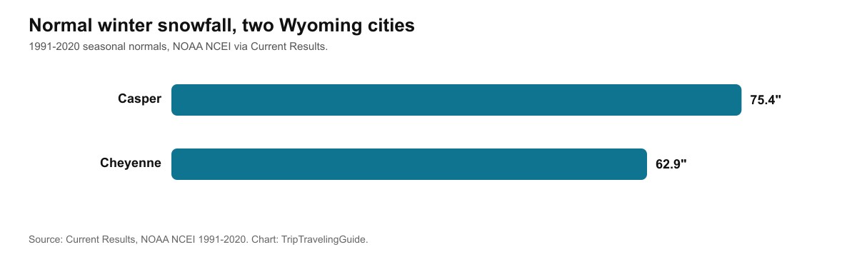
Casper and Cheyenne both average well above 60 inches a season, before the high mountains are even counted.
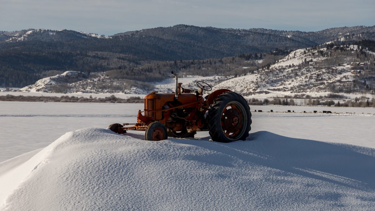
Star Valley, Wyoming, in winter. Photo: Vanveelden, CC BY-SA 4.0.
What are the limits of this guide?
Two different kinds of uncertainty are stacked on top of each other here. The storm numbers for 10-14 October 2026 come from a single meteorologist's outlook, not an official National Weather Service advisory, and mountain snow forecasts routinely shift by a foot or more as a storm gets closer. The seasonal outlook is even softer. Don Day, OpenSnow, and the Farmers' Almanac all point the same general direction for this winter, but El Nino winters have missed Wyoming entirely before, and Day himself said it is too early to know whether this one becomes a true Super El Nino or fizzles out regionally. Treat every number above as an informed estimate, and check the National Weather Service's Riverton or Cheyenne offices directly for anything closer to the dates in question.
Quick answers about Wyoming snow, October 2026
Will it snow in Wyoming, and how much?
Up to 2 feet possible at Gannett Peak, double-digit totals in the Wind River Range, and real accumulation around the Tetons, per a 7 October 2026 outlook.
Is this the same storm that hit Montana and Utah?
Yes. It's the same Hurricane Rachel remnant and cold front combination, moving across the northern and central Rockies over several days.
Is Wyoming's whole winter going to be snowy?
It depends where. Southern Wyoming looks likelier to do well, northern Wyoming may see a second dry winter, and OpenSnow calls the statewide signal a toss-up.
When is Wyoming's first snow of the year?
Cheyenne's average first snow lands around 7 October, per the National Weather Service, with measurable snow by the end of October in about 89 percent of years.
How much snow does Wyoming get in an average year?
Casper averages 75.4 inches a season and Cheyenne averages 62.9 inches, per 1991-2020 climate normals.
Sources
Chris Tomer, Rockies snow outlook, 7 October 2026
Cowboy State Daily, Don Day's winter forecast for Wyoming, 15 September 2026
NOAA Climate Prediction Center, ENSO diagnostic discussion, 8 October 2026
Current Results, Wyoming city snowfall normals (NOAA NCEI 1991-2020)
National Weather Service Cheyenne, average first-snow date
TripTravelingGuide, polar vortex disruption winter 2026-2027
Topics
Advertisement