Alabama Snow Predictions 2026-2027

NOAA's real 2026-2027 outlook for Alabama, Mobile's 130-year snowfall record, city-by-city normals, and every source's forecast compared.
Advertisement
Alabama's 2026-2027 snow outlook: a north-south split, and the exception that broke it
Alabama's snow map is a straight line from north to south, and Huntsville to Mobile is that line's full length: Huntsville averages 2.4 inches a season, Birmingham 1.4, Auburn 0.7, and Mobile on the Gulf Coast just 0.2, on the official NOAA 1991-2020 records. Then in January 2025, Mobile broke every one of those expectations, setting an all-time snowfall record on the part of the state that was supposed to be the safest bet against it.
NOAA's outlook for 2026-2027 sits on top of that same north-south line. A very strong El Nino has the Climate Prediction Center favoring near-normal to slightly cooler temperatures and above-normal precipitation statewide, which keeps north Alabama's Tennessee Valley the more reliable place to expect real snow, without ruling out another coastal surprise. Nobody, CPC included, can promise which of the two this winter will actually be.
This is a research guide built from National Weather Service station records and official NOAA outlooks, not a personal weather diary; we have not travelled to Alabama to watch these storms ourselves. It's part of the same 2026-2027 winter story we're tracking across the USA snow predictions hub.
Does it snow in Alabama 2026 2027 ?
Yes, but not much most years, and it depends heavily on where you are. Alabama sees an average of 2.8 measurable snow events a year statewide (National Weather Service, 1969-1999 study), almost all of them light and almost all of them in the north. Southern and coastal Alabama, from Montgomery to Mobile, can go several winters with nothing measurable at all, while a rare setup, like January 2025's, can drop more snow on the Gulf Coast in one day than a decade of normal winters combined.
When was the last time it snowed in Alabama?
Depends where you mean. For real, measurable snow: 21-22 January 2025, when Mobile, Auburn and Covington County all saw accumulating snow, with Mobile setting an all-time record. For a major winter weather event of any kind: 23-27 January 2026, when Winter Storm Fern brought an ice storm to north Alabama and severe tornadoes to the south, though that event was mostly ice, not snow.
Does Alabama get snow every year?
Not every year, and not everywhere. North Alabama, especially the Tennessee Valley around Huntsville, sees at least a trace most winters. Central and south Alabama frequently go an entire winter with no measurable snow, seeing freezing rain or a cold rain instead when a storm arrives without quite enough cold air behind it.
What NOAA's 2026-2027 outlook says for Alabama
The Climate Prediction Center's long-lead outlook, updated 20 August 2026, favors near-normal to slightly cooler temperatures and above-normal precipitation across Alabama and the wider Southeast, with CPC's own language putting the probability above 60 percent for November-December-January and staying elevated into January-February-March. The driver is a very strong El Nino: NOAA's August ENSO forecast (the RONI index) put the October-December median at +2.66°C, keeping the winter solidly in "very strong" El Nino territory.
More precipitation is not the same as more snow. Whether that moisture reaches Alabama as rain, ice, or snow depends on how much cold air is in place when each storm arrives, and CPC does not, and says it cannot, forecast that months in advance. Neighboring Georgia, Tennessee and South Carolina sit under the same El Nino pattern this season.
All-month snow prediction in Alabama 2026 202
Using the National Weather Service's own monthly normals for Huntsville and Muscle Shoals (1971-2000, the most recent period both stations publish a full monthly breakdown for), snow is effectively a January-and-February event in Alabama, with November and April contributing almost nothing.
Month | Huntsville | Muscle Shoals | Notes |
|---|---|---|---|
November | Trace | Trace | Essentially never |
December | 0.2" | 0.1" | Possible, usually light |
January | 1.0" | 1.3" | The snowiest month at both stations |
February | 0.9" | 0.7" | A close second |
March | 0.3" | 0.4" | Fading fast, but the March 1993 Superstorm hit this month |
April | Trace | Trace | Done |
January and February together carry roughly three-quarters of a normal north Alabama winter's snow. Statewide, the National Weather Service's own Alabama Snow Study (1969-1999, 84 events) confirms the same pattern: January logged 31 of the 84 events, more than any other month, and the first half of February was the single snowiest two-week stretch.
Advertisement
How many inches of snow does Alabama get a year?
On the official NOAA 1991-2020 average, Alabama runs from 2.4 inches a season in Huntsville down to 0.2 in Mobile and effectively 0.0 in Tuscaloosa, one of the widest in-state ranges anywhere in the Southeast for a state with no mountains. There is no single "Alabama average" NOAA publishes, because the number changes completely depending on which city you mean.
Alabama snowfall city by city 2026 2027
Seasonal averages from NOAA's 1991-2020 Climate Normals. The spread is enormous for a single state: Huntsville gets twelve times what Mobile and Tuscaloosa get in an average year.
City | Region | Seasonal normal |
|---|---|---|
Huntsville | Tennessee Valley, north | 2.4" |
Birmingham | Central Alabama | 1.4" |
Auburn | East-central Alabama | 0.7" |
Mobile | Gulf Coast | 0.2" |
Tuscaloosa | West-central Alabama | 0.0" |
Montgomery does not appear in NOAA's published 1991-2020 snowfall normals list for Alabama; we are not going to invent a number for a gap the agency itself left open. Its historical extremes, real and dated, are in the records table below instead.
What every winter forecast source says for 2026-2027
Forecaster | 2026-2027 status | What it actually says |
|---|---|---|
NOAA Climate Prediction Center | Published 20 August 2026 | Near-normal to slightly cooler temperatures, above-normal precipitation. No seasonal snowfall total, by policy. |
Farmers' Almanac | Published its last-ever edition | Announced in November 2025 that it is ceasing publication for good after 208 years, citing financial challenges. Its final outlook calls for a wetter, stormier Gulf Coast and Southeast this winter, but there will not be another one after this. |
Old Farmer's Almanac | Separate publication, still active | Not the same outlet as the Farmers' Almanac above, despite the near-identical name; continues publishing annual long-range outlooks. |
AccuWeather | Seasonal outlook cadence varies | Typically issues its US winter outlook in autumn; check directly closer to the season for Alabama-specific detail. |
Independent audits matter more than any single source's confidence. The Colorado Climate Center scored the Farmers' Almanac against NOAA's Climate Prediction Center across five winters, 2019 to 2024: the almanac scored +1, CPC scored +24, a result the Center called essentially indistinguishable from random guessing. That is the record the Farmers' Almanac closes on.
Alabama snowfall records
The state's all-time extremes belong to Florence, in the northwest, not to any of Alabama's bigger cities: 19.2 inches in a single day on 1 January 1964, and 27.9 inches across the full snow season that year, both state records. Huntsville's 21.4-inch December 1963 monthly total, from the same multi-week cold outbreak, is the second-most-cited extreme in the state's record book.
City | Biggest single day on record | Date |
|---|---|---|
Florence (statewide record) | 19.2" | 1 January 1964 |
Huntsville | 15.7" | 31 December 1963 |
Birmingham | 13.0" | 12-13 March 1993 (the Storm of the Century) |
Mobile | 7.5" | 21-22 January 2025 (all-time record, broke 1895's 6") |
Tuscaloosa | 7.0" | 13 February 1960 |
Montgomery | 3.8" | 13 March 1993 |
Montgomery's all-time snowiest full season is older still: 12.7 inches in 1886-1887, on records that go back to 1872. Birmingham's snowiest season on record is 1992-1993, also 13 inches, meaning its entire season's snow that year fell in one March storm.
Advertisement
Snowfall in Alabama year by year
A full consecutive-year table does not exist in a single published source for any Alabama station the way it does for some other states; NOAA and the National Weather Service publish extremes and normals, not a clean year-by-year season list. What follows is every recent season with a verifiable, sourced total, which is itself the honest picture: most winters bring nothing worth logging, and the exceptions are sharp.
Season | What happened |
|---|---|
2025-26 | Winter Storm Fern (23-27 Jan 2026): an ice storm across north Alabama (19-county state of emergency) and severe tornadoes in the south, not primarily a snow event. |
2024-25 | Two separate storms: ~2" in Birmingham and up to 7" in parts of north Alabama on 10 Jan 2025; then Mobile's all-time-record 7.5" on 21-22 Jan 2025, with Covington County reaching 11". |
2021-22 | Light: 0.6" in Birmingham (2 Jan 2022), 1.3" in Anniston, trace amounts in Montgomery and Tuscaloosa. |
2014-15 | 8.1" in Huntsville on 25 Feb 2015, the city's second-biggest single day on record. |
1992-93 | The March 1993 "Storm of the Century": 13" in Birmingham and Anniston, 3.8" in Montgomery, all in a single storm on 12-13 March. |
1963-64 | Alabama's biggest snow season on record: 24.1" in Huntsville, including a 15.7" single day on 31 Dec 1963, and Florence's state-record 19.2" single day on 1 Jan 1964. |
Mobile's historic January 2025 snowstorm
This is the single fact that should reframe how anyone reads an Alabama snow forecast: on 21-22 January 2025, the National Weather Service office in Mobile measured 7.5 inches of snow, breaking the city's all-time record of 6 inches, a mark that had stood since 1895, roughly 130 years. Covington County, further inland, reported the storm's highest total at up to 11 inches. The same system dropped about 2 inches in Auburn, with pockets of 5 to 6 inches from Pike County into Barbour County, while most areas north of I-85, including Montgomery, saw only light accumulation.
Averages describe a typical winter. Mobile's 0.2-inch normal describes almost every year since 1991. It does not describe January 2025, and that gap is the whole reason a "does it snow in Alabama" answer has to include both numbers, not just one.
Winter Storm Fern: what happened in January 2026
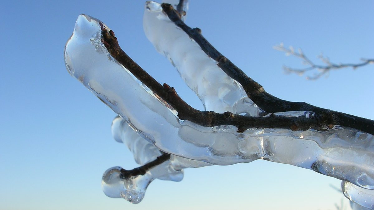
Alabama's most recent widely covered winter event was not primarily a snow story. From 23 to 27 January 2026, Governor Kay Ivey declared a state of emergency for 19 northern Alabama counties ahead of expected ice accumulation, while the same system produced severe thunderstorms and tornadoes across the south on 25 January, including an EF2 tornado in Geneva County with 115 mph winds and a 71 mph wind gust recorded near Montgomery. For most of the state, Fern is remembered for ice and severe weather, not snow depth, which is exactly why lumping "Alabama winter storms" into one number misses what actually matters locally: north Alabama's risk is ice, south Alabama's is often severe convection riding the same system.
Does north Alabama get more snow than south Alabama?
Usually, yes, and by a wide margin: Huntsville's 2.4-inch normal is twelve times Mobile's 0.2. The National Weather Service's own Alabama Snow Study backs this up, finding the Appalachian foothills and Northern Valley regions logged the most events of any part of the state studied. January 2025 is the exception that proves the rule needs a caveat: Mobile's 7.5-inch record happened while areas north of I-85 saw almost nothing, because a rare setup let cold air pool at the surface on the coast in exactly the right storm track. That kind of event is uncommon, not impossible.
Tips for staying safe in the snow or ice
Watch for ice, not just snow. Alabama's most disruptive recent event (Fern, January 2026) was mainly an ice storm. A thin coat of ice is more dangerous per inch than the same depth of dry snow.
Expect cities to close at low totals. Alabama does not run a northern-scale plow and salt fleet, because a genuinely disruptive event happens under three times a year statewide on average.
Bridges and overpasses ice first. They lose heat faster than flat roadway and are where most weather-related crashes cluster.
Go north for the better odds. If seeing snow is the actual goal, Huntsville and the Tennessee Valley have the state's best real average; the Gulf Coast is a lottery ticket, not a plan.
January is the month to watch. Both the statewide Snow Study and the Huntsville/Muscle Shoals monthly normals agree: January carries more of an Alabama winter's snow than any other month.
Our take
If you want the best realistic chance of seeing snow in Alabama this winter, watch north Alabama and the Tennessee Valley around Huntsville, not the coast. It has the state's highest average, and the National Weather Service's own multi-decade study backs that pattern. Do not write the Gulf Coast off completely: Mobile's January 2025 record proves a rare setup can beat the odds entirely, and it happened only two winters ago. What we would not do is plan a trip around one specific city and date this far out, and we would treat any Farmers' Almanac reference as a historical curiosity now, not a forecast; NOAA's outlook, imperfect as it is, is simply the more accurate one on the record.
Topics
Frequently asked questions
Advertisement