Chicago Winter Forecast 2026-2027: What 77 Years of Data Show

NOAA expects a historic El Nino. In Chicago's last 7 strong El Nino winters, O'Hare, Midway and Rockford all landed near 66-70 percent of normal snow.
Advertisement
Chicago's winter forecast for 2026-2027 depends on who you ask, and on which Chicago you mean. O'Hare, Midway and the far suburbs do not always see the same winter, and the city's own climate record has moved between four different sites since 1871. We pulled 77-plus years of NOAA station data to find out what actually happens here in a strong El Nino winter.
What is Chicago's winter forecast for 2026-2027?
Milder than normal, according to NOAA, the Old Farmer's Almanac and the Farmers' Almanac alike, but not snow-free. All three point to a strong to historic El Nino, above-normal temperatures, and real cold, snowy windows concentrated in January. None of them give a snowfall number in inches.
That agreement across three independent sources is worth taking seriously. It is also not the whole story, because "milder than normal" describes an average, and Chicago's own record shows that strong El Nino winters still produce real snow, just usually less of it than a typical year.
What does NOAA say about this winter?
NOAA's Climate Prediction Center put the July Nino-3.4 index at plus 1.4 degrees in its ENSO diagnostic discussion, issued 13 August 2026, and gave a greater than 90 percent chance of a very strong El Nino this fall and winter.
The same discussion put the odds at 69 percent for a historic event that would exceed every El Nino on record back to 1950. Its next update is due 10 September 2026, four days after this guide was published, so the current-season section below is worth rechecking against that release.
What does the Old Farmer's Almanac predict for Chicago?
Warmer than normal and less snowy, with a catch. Chicago falls in the almanac's Lower Lakes region, and its 2026-2027 forecast page, live as of 4 September 2026, calls for above-normal precipitation and what it describes as a classic winter January.
Its snowfall call for the region is near to below normal, with the snowiest periods flagged for early and late January and early February. Temperatures are called above normal, with the coldest stretches also landing in early January and early February.
What does the Farmers' Almanac predict for the Great Lakes?
Near-normal temperatures, and an explicit warning that near-normal does not mean a mild winter for the region Chicago sits in. Its 2026-2027 forecast, published 6 August 2026 and updated 3 September, groups Chicago with the wider Great Lakes and Ohio Valley region.
The wording describes fast-moving clippers, sudden cold snaps, brief snowy periods, snow squalls and bursts of bitter cold, interrupted by milder breaks. Like every seasonal almanac forecast we have read, it gives no snowfall figure in inches for any specific city.
Which Chicago? O'Hare, Midway, or somewhere else?
All three, at different times. The city's official climate record sat downtown from 1871 to 1925, moved to the University of Chicago from 1926 to 1942, then to Midway Airport from 1942 to 1980, and has been recorded at O'Hare since 17 January 1980, confirmed directly from WGN-TV's own station history.
That matters because O'Hare and Midway do not report identical snowfall, and a number that sounds like "the Chicago average" depends entirely on which site and which era it came from. We use all three stations below rather than pick one.
How much snow does Chicago get in a strong El Nino winter?
Around two-thirds to three-quarters of normal. Across seven winters since 1957 with an El Nino strong enough to match what NOAA expects this year, O'Hare averaged 70 percent of its normal snowfall, Midway 66 percent, and Rockford 69 percent, three separate stations landing in the same narrow band.
That convergence, from stations with different records and different data gaps, is the most defensible thing our own analysis found. It is a below-normal signal, not a snowless one, and it says nothing about any single storm this winter.
| Winter | ONI (DJF) | O'Hare | Midway | Rockford |
|---|---|---|---|---|
| 1957-58 | +1.69 | no data | 20.0" | 17.5" |
| 1972-73 | +1.55 | 25.6" | 32.9" | 26.6" |
| 1982-83 | +2.14 | 26.6" | 22.1" | 28.0" |
| 1991-92 | +1.54 | 28.4" | 24.1" | 30.6" |
| 1997-98 | +2.22 | no data | 34.7" | no data |
| 2015-16 | +2.50 | 31.2" | 27.8" | 24.0" |
| 2023-24 | +1.84 | 22.2" | 18.4" | 27.3" |
| Average % of normal | 70% (5 seasons) | 66% (7 seasons) | 69% (6 seasons) |
O'Hare and Rockford are both missing 1997-98, the strongest post-1980 El Nino before this one, because more than five of that winter's core days came back missing in the daily record. Midway's twin station has that season complete, which is why its average uses all seven winters and the other two use five and six.
Advertisement
Was last winter (2025-26) unusual?
Yes, at the start, and then no. The National Weather Service's Chicago office recorded the quickest start to winter at O'Hare since 1978 and the snowiest start on record at Rockford, with 17.1 inches down at both sites by 7 December 2025.
The season did not stay that far ahead of normal. It finished at 34.1 inches at O'Hare, 30.7 at Midway and 30.8 at Rockford, all close to or slightly below each station's own normal, a reminder that a fast start is not the same thing as a big season.
How do the last five winters compare?
Unevenly, and by a lot in one particular year. 2021-22 is the season where the three stations diverge the most sharply: Midway logged 41.5 inches, O'Hare 32.8, and Rockford only 21.9, a 20-inch gap between the wettest and driest of three stations that sit within about 70 miles of each other.
We cannot fully explain that spread and are not going to invent a mechanism to cover it. What the table shows plainly is that a single winter's total at one Chicago-area station is a poor stand-in for what the whole region saw.
| Winter | O'Hare | Midway | Rockford |
|---|---|---|---|
| 2021-22 | 32.8" | 41.5" | 21.9" |
| 2022-23 | 20.2" | 16.9" | 35.5" |
| 2023-24 | 22.2" | 18.4" | 27.3" |
| 2024-25 | 17.6" | 14.8" | 17.1" |
| 2025-26 | 34.1" | 30.7" | 30.8" |
| 1991-2020 normal | 38.4" | 38.8" | 37.1" |
Does a very strong El Nino behave differently from a strong one?
Not by much, at least in Chicago. Narrowing to the three winters where the ocean index reached 2.0 or higher, the category NOAA currently expects this winter to enter, O'Hare averaged 75 percent of normal, Midway 73 percent, and Rockford 70 percent, all close to the seven-winter figures above.
Ohio's record showed a wider gap between its strong and very strong subsets. Chicago's does not, which is itself worth stating rather than forcing a parallel that the data does not support.
| Winter | ONI (DJF) | O'Hare | Midway | Rockford |
|---|---|---|---|---|
| 1982-83 | +2.14 | 69% | 57% | 75% |
| 1997-98 | +2.22 | no data | 89% | no data |
| 2015-16 | +2.50 | 81% | 72% | 65% |
| Average | 75% (2 seasons) | 73% (3 seasons) | 70% (2 seasons) |
When does it usually start snowing in Chicago?
Late November, on average, with a wide range around it. O'Hare's median date for its first inch of snow is 30 November across 64 seasons of record, Midway's is 24 November across 96 seasons, and Rockford's is 29 November across 73 seasons.
The range around that median is wide enough to matter for planning. O'Hare has seen its first inch as early as 19 October, in 1989-90, and as late as 25 January, in 2012-13, a three-month spread around the same "typical" date.
| Station | Median first 1" | Earliest on record | Latest on record |
|---|---|---|---|
| O'Hare | 30 Nov | 19 Oct (1989-90) | 25 Jan (2012-13) |
| Midway | 24 Nov | 19 Oct (1989-90) | 18 Feb (1933-34) |
| Rockford | 29 Nov | 26 Oct (1959-60) | 16 Jan (2001-02) |
When does snow usually stop for the season?
Mid to late March, with occasional snow well into spring. O'Hare's median date for its last inch of the season is 20 March, Midway's is 18 March, and Rockford's is 23 March, all landing within a few days of each other despite very different record lengths.
The latest end to a season at both O'Hare and Rockford came in 1965-66, when a measurable inch fell as late as 11 May. That is an outlier, not a pattern, but it is on the record at both stations in the same year.
What is Chicago's biggest snowstorm on record?
The blizzard of 26-27 January 1967, when Midway, the official station at the time, recorded 16.4 inches on the first day and 6.6 on the second for a two-day total of 23.0 inches. That figure matches the storm's widely cited 23-inch total exactly, confirmed against our own daily station data rather than taken secondhand.
It remains one of the most documented blizzards in United States weather history, and Chicago's official station has recorded nothing bigger since, across nearly six decades and both of the sites that have held that role.
What is Chicago's snowiest single calendar day on record?
2 January 1999, when O'Hare, the official station since 1980, recorded 18.6 inches in one calendar day. Independent reporting from ABC7 and Weather.com describes the same date as the city's heaviest calendar-day snowfall on record, and the wider storm from 1 to 3 January 1999 totaled 21.6 inches at the airport.
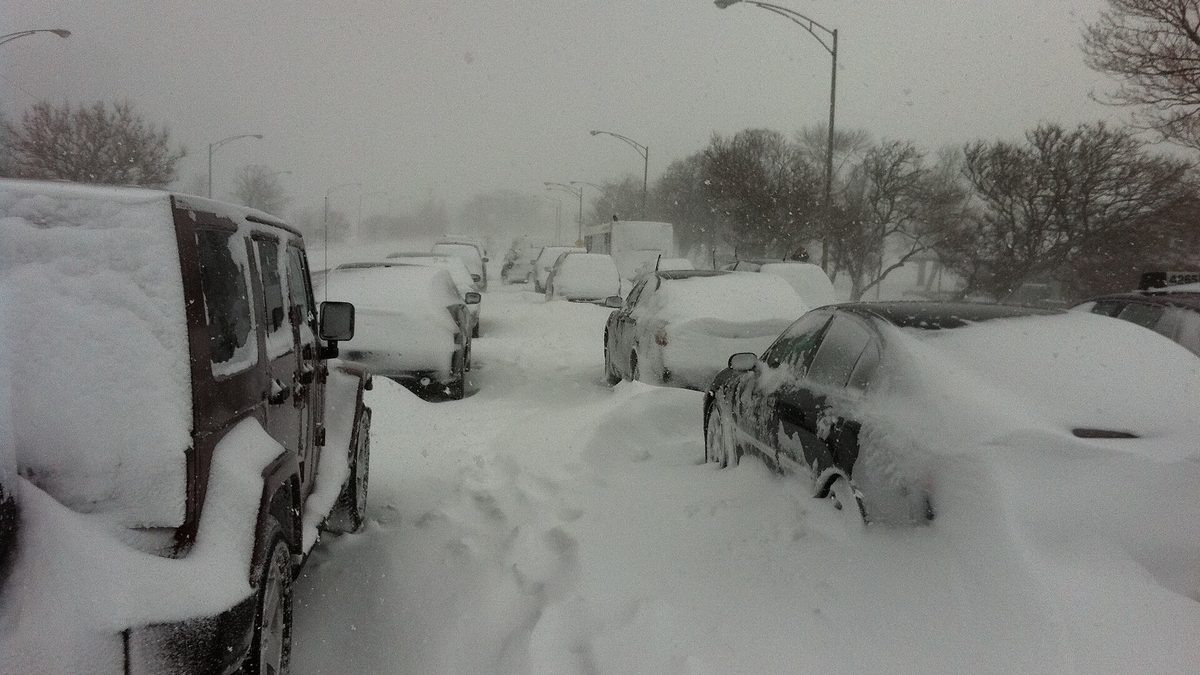
That storm shut down Lake Shore Drive for the first time in the road's history and grounded roughly 300 flights each at O'Hare and Midway, disruption on a scale that a bare inches figure does not fully convey.
This is a different record from the one usually quoted for the 2011 Groundhog Day blizzard, and the distinction matters. That storm's widely cited 20 inches fell across a rolling 24-hour clock spanning parts of two calendar dates, 13.6 inches on 1 February and 6.6 on 2 February by our own station data, which is why it does not appear as a single-day figure here even though the storm's three-day total, 21.2 inches, was the larger event by any measure.
Advertisement
What was Chicago's biggest snow winter on record?
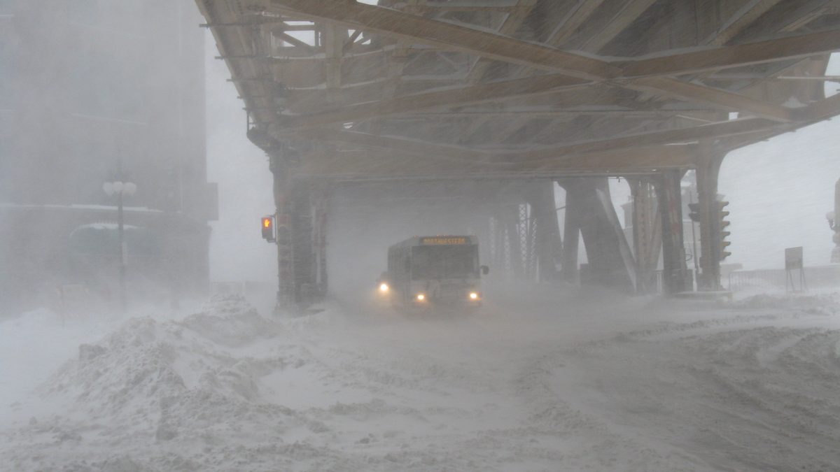
1978-79, at all three stations at once: 83.7 inches at O'Hare, 89.7 at Midway, and 74.5 at Rockford, each the highest season either station has ever recorded. It is also, by ocean index, an unremarkable neutral winter, with an ONI of plus 0.19, nowhere near El Nino territory.
That single fact complicates any tidy story about El Nino controlling Chicago's snow. The record season on the books came from a winter the ENSO index says should have been ordinary, and the current forecast's El Nino framing describes a tendency, not a guarantee.
| Station | 1991-2020 normal | Snowiest season on record | Least snowy season on record |
|---|---|---|---|
| O'Hare | 38.4" | 83.7" (1978-79) | 17.6" (2024-25) |
| Midway | 38.8" | 89.7" (1978-79) | 10.7" (1936-37) |
| Rockford | 37.1" | 74.5" (1978-79) | 11.0" (1967-68) |
One storm inside that record 1978-79 season is still remembered for reasons that have nothing to do with the snow total. The blizzard of 12 January 1979 dropped 20.3 inches, widely reported as the fourth largest snowstorm in the city's history, buried streets and cars for days, and is generally credited with costing Mayor Michael Bilandic his re-election that spring.
Does Rockford get more snow than Chicago?
Not by much, on average, which is not what most people would guess about a more inland, more continental site. Rockford's 1991-2020 normal is 37.1 inches, close to O'Hare's 38.4 and Midway's 38.8, though individual winters can still swing sharply between the three.
The three stations sit close enough in their long-run averages that the lake's moderating effect on Chicago proper and the plains-style winters further inland roughly cancel out over 30 years, even though single seasons like 2021-22 look nothing alike.
Is Chicago affected by lake-effect snow?
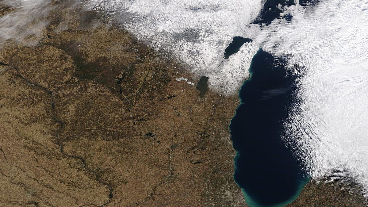
Rarely, and that comes down to geography rather than luck. Chicago sits on the southwestern shore of Lake Michigan, and the lake-effect bands that form over the open water need a long fetch of wind across it, which for this lake mostly means a northwesterly or westerly flow.
That wind direction carries the heaviest lake-effect bands away from Chicago and toward Michigan's west shore instead, the same mechanism our Michigan snow guide covers from the other side of the lake. Chicago's own snow comes mostly from synoptic storm systems, not the lake sitting next to it.
Should you cancel travel plans based on this forecast?
Not on a seasonal outlook alone. NOAA, the Old Farmer's Almanac and the Farmers' Almanac all describe a tendency for this winter, not a day-by-day forecast, and none of them can tell you whether a specific flight or a specific weekend drive around Chicago will run into snow.
Both almanacs are candid that they are describing a season's character rather than predicting individual storms, and our own station data backs that caution up: even the record snowiest season on the books, 1978-79, arrived in a winter the ENSO index called ordinary.
What should you check closer to your travel date?
The National Weather Service forecast for Chicago specifically, issued a week or less out, rather than a seasonal outlook. A seasonal outlook and a short-range forecast are different products built from different data, and neither is a weaker version of the other.
For planning further out than that, a station's own 30-year normal and its historical range, the kind of numbers in the tables above, tell you what a typical winter delivers and how far from typical it can land, without anyone having to predict anything.
The limits of this analysis
Three stations across one metro area is not a statewide picture, and six or seven strong-El-Nino seasons per station is a small sample by any standard. O'Hare and Rockford are both missing 1997-98 specifically, so their strong-winter averages lean slightly more on the other six seasons than Midway's does.
We are also treating the Farmers' Almanac and the Old Farmer's Almanac as two different publications with two different regional systems, and we have not merged their claims into a single number. Our full method for testing an almanac's track record, separate from this piece, is in our Farmers' Almanac accuracy guide, and the same seven-winter ONI framework used here is applied to a different state in our Ohio snow guide. For the wider national picture, see our USA winter snow predictions hub.
Topics
Advertisement