When Will It First Snow This Year? First Snowfall Dates by US State

Denver's average first snow is Oct 16, NYC's is Dec 14. See NOAA's real first-snowfall dates by city and state, plus this year's month-by-month outlook.
Advertisement
Snow prediction 2026-2027: when will it first snow?
This guide answers one question: when does the season's first snow usually arrive where you live, for winter 2026-2027? It is not a guess about one storm. It uses real government weather records going back 30 years, plus this year's official seasonal outlook.
Short version: the first snow reaches the highest Rocky Mountain peaks by late September. It spreads through the northern states in October and November. It doesn't reach the Deep South until January, if it comes at all.
Denver's 30-year average first snow date is October 16. New York City's is December 14, almost two months later, even though both cities sit at a similar latitude. Read on for the full state-by-state and city-by-city picture, this year's specific outlook, and what other forecasters are saying, all in one place.
Figures are current as of 28 September 2026. Every date below is a multi-decade historical average, not a prediction of the exact day snow will fall this winter.
What counts as "first snow"? The definition matters
Meteorologists track three separate moments, and they can be weeks apart.
First flakes: snow was seen falling, even if it melted right away.
First measurable snowfall: at least 0.1 inch built up on the ground. This is the official threshold the National Weather Service uses for its climate records.
First significant snowfall: an inch or more piled up. This is the one most people actually notice, and usually the first day you reach for a shovel.
NOAA's own definition is even more precise. It is the date by which there is a 50% chance that at least 0.1 inch of snow has built up, based on weather station records from 1981 to 2010. Every "average first snow" date in this guide uses that measurable-snow standard, not the first snowflake anyone happens to see.
First snow 2026-2027: this year's month-by-month outlook
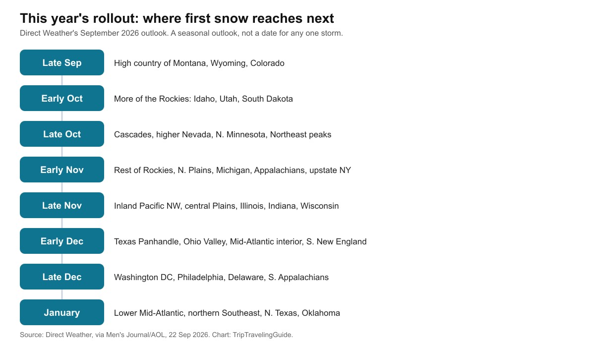
Forecaster Direct Weather published a seasonal outlook for winter 2026-2027 in September 2026. It maps out roughly when different parts of the country should expect their first snow this year, moving from the mountains outward.
This is a seasonal outlook. It is not a forecast for one specific storm, and it does not name an exact date for any single town.
| 2026-2027 timing | Where |
|---|---|
| Late September 2026 | High country of Montana, Wyoming and Colorado |
| Early October 2026 | More of the Rockies: Idaho, Utah, South Dakota, the Dakotas |
| Late October 2026 | Cascades, higher Nevada, northern Minnesota, Michigan's Upper Peninsula, Northeast high peaks (Adirondacks, Green Mountains, White Mountains, interior Maine) |
| Early November 2026 | Rest of the Rockies and Sierra Nevada, northern Plains, Iowa, Wisconsin, most of Michigan, the Appalachians, upstate New York, northern Pennsylvania |
| Late November 2026 | Inland Pacific Northwest, central Plains, parts of Illinois, Indiana and Wisconsin |
| Early December 2026 | Texas Panhandle, western Oklahoma, more of Kansas and Missouri, Ohio Valley, Mid-Atlantic interior, southern New England |
| Late December 2026 | Washington DC, Philadelphia, Delaware, southern New Jersey, the Smoky Mountains and southern Appalachians |
| January 2027 | Lower Mid-Atlantic, northern Southeast, northern Texas, southern Oklahoma, much of Arkansas |
What do other winter 2026-2027 forecasts say?
We checked the main US seasonal forecasters so you don't have to visit five different sites. Here is where they agree, and where they don't.
NOAA's Climate Prediction Center is the official US government forecaster. It puts the odds of a very strong El Niño at greater than 90% this winter. Its own September-to-November 2026 outlook favors above-normal temperatures across much of the western and central US, the Great Lakes, the Northeast and the Gulf Coast.
Direct Weather's month-by-month rollout, shown above, is built around that same El Niño signal.
Farmers' Almanac agrees on the historical pattern (mountains first, South last) but frames its own 2026-2027 winter forecast as calling for above-normal snow in parts of the Northeast, Appalachians, Intermountain West, Pacific Northwest and Alaska, alongside a generally mild winter overall.
Where they overlap: every forecaster we checked points to a warmer-than-average autumn for most of the country because of El Niño. That points toward first-snow dates arriving on the later side of the historical average this year, especially in the Great Lakes, Northeast and Gulf Coast.
Where they differ: El Niño's biggest effects usually show up in December through February, not during the early-season rollout. So the "who gets snow first" order above is unlikely to change much, even if the exact dates end up a bit later than average.
None of these are a promise. A single early cold snap can still beat every seasonal outlook.
Average first snow dates: Northeast, Midwest and West
Averages fall earliest in the high mountains and the far north. They get later as you move south and toward the coasts.
The table below uses NOAA, NWS and NCEI's 30-year climate data, as compiled by The Weather Channel. It also shows the earliest first snow ever recorded at each station, so you can see how much a single year can differ from the average.
Advertisement
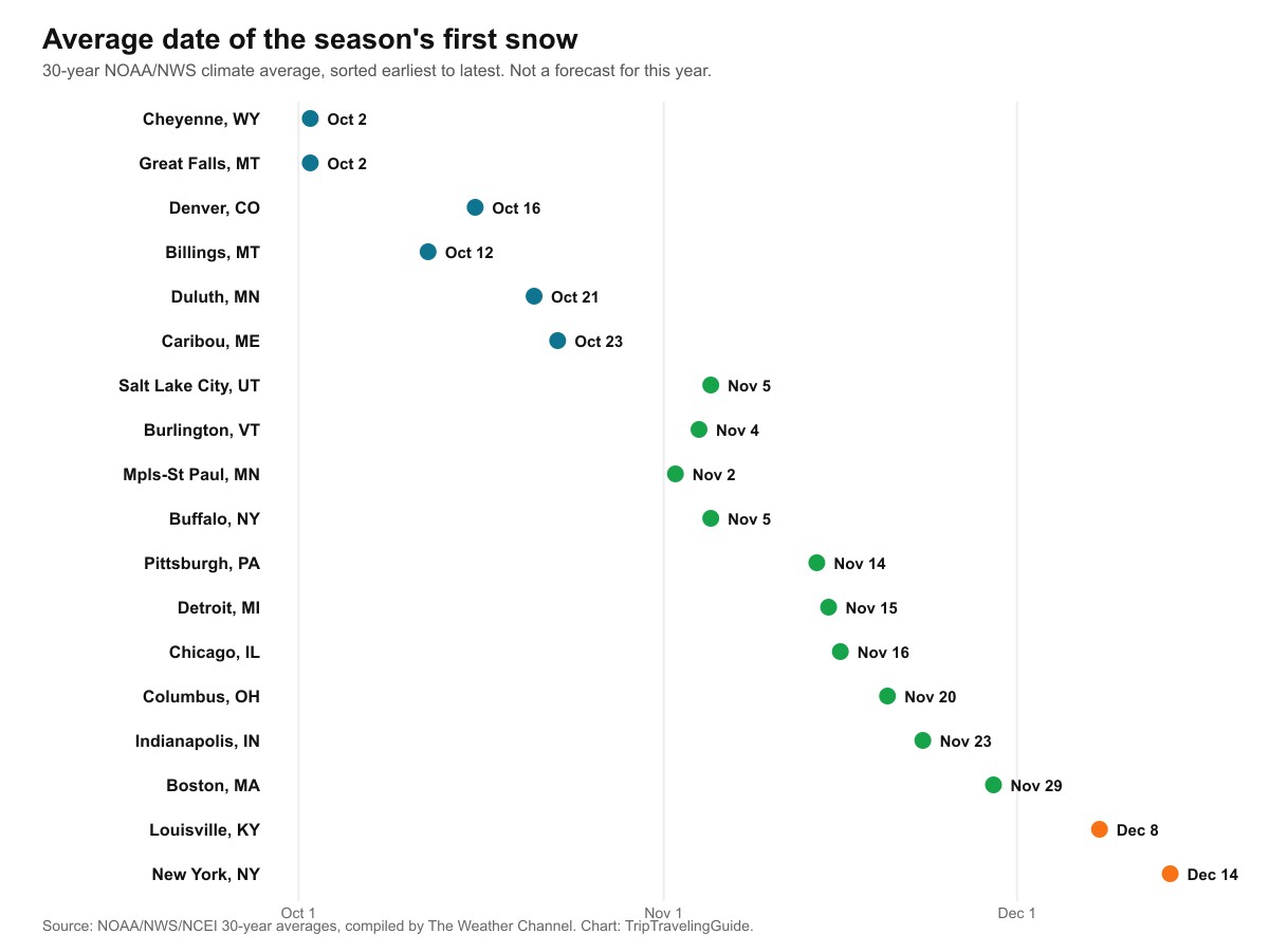
| City | Average first snow | Earliest on record | Average season snowfall |
|---|---|---|---|
| Great Falls, MT | Oct 2 | Aug 22, 1992 | 61.6 in |
| Cheyenne, WY | Oct 2 | Sep 8, 1929 | 60.0 in |
| Billings, MT | Oct 12 | Sep 7, 1962 | 55.6 in |
| Denver, CO | Oct 16 | Sep 3, 1961 | 60.1 in |
| Duluth, MN | Oct 21 | Sep 18, 1991 | 81.5 in |
| Caribou, ME | Oct 23 | Sep 29, 1991 | 111.8 in |
| Salt Lake City, UT | Nov 5 | Sep 17, 1965 | 56.0 in |
| Minneapolis-St Paul, MN | Nov 2 | Sep 24, 1985 | 53.4 in |
| Burlington, VT | Nov 4 | Sep 30, 1992 | 82.2 in |
| Buffalo, NY | Nov 5 | Oct 6, 1991 | 92.5 in |
| Pittsburgh, PA | Nov 14 | Oct 18, 1992 | 41.4 in |
| Detroit, MI | Nov 15 | Oct 12, 2006 | 43.8 in |
| Chicago, IL | Nov 16 | Oct 12, 2006 | 37.1 in |
| Columbus, OH | Nov 20 | Oct 10, 1906 | 27.1 in |
| Indianapolis, IN | Nov 23 | Oct 18, 1989 | 25.5 in |
| Boston, MA | Nov 29 | Oct 10, 1979 | 43.5 in |
| Louisville, KY | Dec 8 | Oct 19, 1989 | 13.4 in |
| New York, NY | Dec 14 | Oct 21, 1952 | 25.3 in |
Two things stand out. Boston's October 10, 1979 record and New York's October 21, 1952 record both happened decades before either city's average date. That's exactly what "average" means: half of all years ran earlier, half ran later.
Denver's average of October 16 also sits earlier than Boston's or New York's, despite being much further inland and further from the ocean's moderating effect.
When does it snow in the South, if at all?
South of roughly the Ohio Valley, snow doesn't fall reliably enough for a single "average date" to mean much. Instead, climatologists give a window, the average span between the first and last measurable snowfall of the year. For most of the South, that runs from late December into February.
| City | Typical snow window | Average season snowfall |
|---|---|---|
| Nashville, TN | Dec 30 to Feb 27 | 5.0 in |
| Knoxville, TN | Jan 3 to Feb 18 | 6.4 in |
| Raleigh, NC | Jan 4 to Feb 14 | 5.9 in |
| Memphis, TN | Jan 12 to Feb 9 | 3.7 in |
| Little Rock, AR | Jan 13 to Feb 8 | 3.5 in |
| Dallas, TX | Jan 13 to Feb 9 | 1.7 in |
| Charlotte, NC | Jan 18 to Feb 7 | 4.2 in |
| Norfolk, VA | Jan 17 to Feb 22 | 4.7 in |
| Atlanta, GA | Jan 21 to Feb 8 | 2.6 in |
| Birmingham, AL | Jan 29 to Feb 9 | 1.6 in |
| Columbia, SC | Jan 26 to Feb 4 | 1.5 in |
Georgia, Alabama, Louisiana and coastal South Carolina can go entire winters without measurable snow. When southern snow does happen, it usually comes from one sharp cold outbreak, not a predictable seasonal pattern.
That's why our Georgia, Alabama and South Carolina guides treat any snow there as an event worth planning around, not a certainty.
Why do nearby towns get their first snow on different days?
Six factors decide when your first flakes arrive. They can outweigh each other in surprising ways.
- Elevation. Temperature drops roughly 3 to 5°F for every 1,000 feet you climb. That's why Denver turns white weeks before towns at the same latitude but sea level.
- Latitude. Northern locations lose daylight faster in autumn, so they cool off earlier.
- The Great Lakes. Cold air crossing the lakes' still-warm autumn water picks up moisture and drops it as lake-effect snow downwind. That's why Buffalo, averaging November 5, beats cities at a similar latitude that sit away from the lakes.
- The ocean. Large bodies of water hold their warmth. That's part of why coastal Boston and New York run weeks behind inland Denver, despite being no further south.
- Urban heat. Big cities hold onto a degree or two more warmth than nearby rural areas. Sometimes that's the difference between snow sticking and melting on contact.
- That year's weather pattern. Averages are not forecasts. One early Arctic outbreak can bring snow weeks ahead of schedule. A warm autumn, like the one El Niño points toward this year in several regions, can push it later than usual.
First snow prediction 2026-2027, city by city
These are the places readers ask us about most. Each one below has its own paragraph, its historical average, and a link to our full winter guide for that state.
Colorado (Denver): first snow prediction 2026-2027
Denver's 30-year average first snow date is October 16, though the city has recorded measurable snow as early as September 3. The Colorado high country, above Denver's elevation, typically turns white weeks earlier than the metro area itself. For the full winter outlook, see our Colorado snow predictions.
Buffalo, New York: first snow prediction 2026-2027
Buffalo's average is November 5, nearly six weeks earlier than New York City despite being in the same state. Lake-effect snow off Lake Erie is the reason: cold air crossing the still-warm lake in autumn picks up moisture fast. See our Buffalo snow forecast for the full season outlook.
Michigan (Detroit): first snow prediction 2026-2027
Detroit's average first snow date is November 15. Michigan's Upper Peninsula sits much closer to Lake Superior, and typically sees its first snow weeks earlier, often by late October. Full details are in our Michigan snow predictions.
Chicago: first snow prediction 2026-2027
Chicago's average first trace of snow falls in late October. Measurable snowfall, the 0.1-inch threshold, averages November 16. Our Chicago winter forecast covers the rest of the season.
Ohio (Columbus): first snow prediction 2026-2027
Columbus averages its first snow on November 20, with a record as early as October 10, 1906. Our Ohio snow predictions guide has the full winter picture.
Advertisement
Boston: first snow prediction 2026-2027
Boston's average is November 29, with a record as early as October 10, 1979. That's later than most inland Northeast cities, since the ocean moderates the coast's autumn temperatures. See our Boston snow forecast for more.
Kentucky (Louisville): first snow prediction 2026-2027
Louisville's average first snow date is December 8. Our Kentucky snow predictions page has the season's full outlook.
New York City: first snow prediction 2026-2027
New York City's average is December 14, one of the latest average dates of any major Northeast city, because the coast holds its warmth longer than inland areas. Our New York winter forecast covers the rest of the state too.
Pennsylvania (Pittsburgh): first snow prediction 2026-2027
Pittsburgh's average first snow date is November 14, well ahead of Philadelphia and the rest of eastern Pennsylvania, thanks to its higher elevation and distance from the coast. See our Pennsylvania snow predictions for the state-wide picture.
Tennessee (Nashville): first snow prediction 2026-2027
Nashville doesn't have a single average date. Instead, its typical snow window runs from December 30 to February 27. Our Tennessee snow predictions guide explains why the South works this way.
What are the limits of this data?
The city averages come from a 30-year climate normal, compiled and published by The Weather Channel on 9 October 2017, drawing on NOAA, NWS and NCEI records.
We could not access the underlying NWS Louisville office chart that some of these figures trace back to directly, since it's published as an image rather than a data table. So we relied on this secondary compilation, and cross-checked it against Farmers' Almanac's own September 2026 summary of the same climate record. The two agreed on every city we could compare.
Averages describe multi-decade climate history, not this year. NOAA itself frames the normal date as a 50% probability point, meaning roughly half of all years in the record saw their first snow later than the date shown.
The "this year" rollout section comes from a single forecaster's seasonal outlook, published in September, months before winter. It describes broad regional timing, not an exact date for any specific town. We make no prediction of when snow will actually fall in your location this year.
Quick answers about the first snow of 2026-2027
When will it first snow this year?
It depends entirely on where you live. High Rocky Mountain country typically sees its first snow by late September. Most of the northern US follows in October and November. The South often waits until January, if it snows at all.
When will it first snow in Colorado?
Denver's 30-year average is October 16, though the city has recorded measurable snow as early as September 3.
When will it first snow in New York City?
New York City's average is December 14. Upstate New York is very different: Buffalo averages November 5, nearly six weeks earlier, because of lake-effect snow off Lake Erie.
When does it start snowing in Boston?
Boston's 30-year average is November 29, with a record as early as October 10, 1979.
When will it first snow in Michigan?
Detroit's average is November 15. Michigan's Upper Peninsula, closer to Lake Superior, typically sees its first snow weeks earlier.
When will it first snow in Utah?
Salt Lake City's average is November 5, though Utah's higher mountains, including the Wasatch, typically see snow in October.
Will winter 2026-2027 bring snow earlier or later than usual?
NOAA's own fall outlook favors a warmer-than-average autumn across much of the country because of a strong El Niño. That points toward first-snow dates landing on the later side of the historical average in many places, though it's not a guarantee for any single town.
Does it ever snow before winter officially begins?
Regularly. Astronomical winter doesn't start until the December solstice, December 21 in 2026, but most of the northern US sees its first snow well before then. Meteorological winter, used for climate recordkeeping, begins December 1.
Sources and method
- The Weather Channel, "When the First Snow of the Season Typically Falls" (Jon Erdman, 9 October 2017): the city-by-city 30-year average first snow dates, earliest-on-record dates and average season snowfall, sourced to NOAA, NWS and NCEI. Accessed 28 September 2026.
- Farmers' Almanac, "First Snowfall Where I Live" (updated 11 September 2026): the three-milestone definition (first flakes, first measurable, first significant), the regional first-snow map, and confirmation of Denver's average and record. Accessed 28 September 2026.
- NOAA Climate.gov, "First dates: when does the climate record say you can expect the season's first snow?": the 50%-probability definition of the climate-normal first-snow date, based on 1981-2010 records. Accessed 28 September 2026.
- Direct Weather's September 2026 first-snowfall outlook, as reported by Men's Journal via AOL, "New Map Reveals When Every U.S. State Will Get First Snowfall" (22 September 2026): the month-by-month regional rollout for this winter. Accessed 28 September 2026.
- NOAA's Climate Prediction Center September-November 2026 outlook and the greater-than-90%-chance El Niño figure, plus Farmers' Almanac's own 2026-2027 winter forecast, as reported in FinChannel's 2026-27 winter outlook summary. Accessed 28 September 2026.
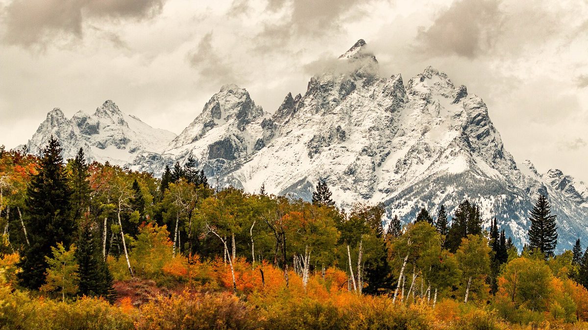
- Cover photograph: snow on the Cathedral Group of the Teton Range above autumn foliage, Grand Teton National Park, 22 September 2017, by NPS/Adams, public domain, via Wikimedia Commons.
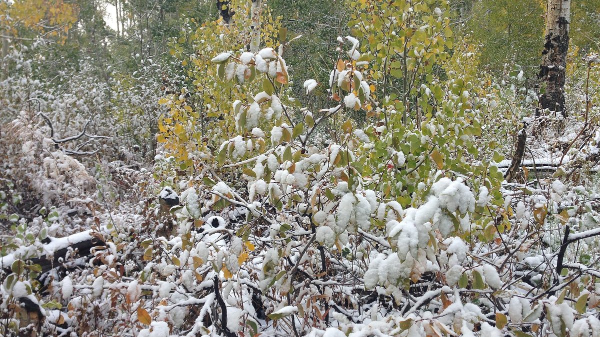
- Foliage photograph: an early autumn snowfall on choke cherries and aspens along the Changing Canyon Trail, Lamoille Canyon, Nevada, 26 September 2013, by Famartin, CC BY-SA 3.0, via Wikimedia Commons.
For this winter's full seasonal outlook, see our USA winter forecast 2026-2027, and for the holiday travel angle, our guide to white Christmas odds by city and state.
Topics
Advertisement